Advertisement
Published: October 11th 2007

 Hushe entrance
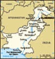
We finally made Hushe valley after days of walking, beautiful weather with massive walls of granite everywhere...After our Rakaposhi Base Camp trek, we got excited and ready to do a little more extensive trekking. We found that our tent was more comfortable than in the villages (and way cheaper, too) and eating our campfood was easier on our stomachs. So we boarded another bus for Skardu, which is the base for climbing and trekking expeditions in the Baltistan area. We know of several American and Canadian parties on expeditions there, so we have a thought in the back of our minds that we will maybe see them in their base camps.
Skardu The ride to Skardu was perhaps the scariest road I’ve been on in awhile… I’ve subsequently been told that it’s referred to as ‘the road that eats jeeps.’ Imagine Engineer Pass with class VI rapids in bottom of the gorge, a one-lane dirt road with two-way traffic, mainly trucks and buses. I was glad that we were on the inside whenever we met oncoming traffic, and even more glad to know that our plans have us trekking back across this way so that we won’t have to have the experience on the outside!
There is less military presence in Skardu than we saw
Thalle La Camping
Don't sniff too deeply, dinner smells good but there's a dead cow behind the tent. in Gilgit, but just as much honking, fewer women, and generally not much tourism. Between Ramadan and the fact that we are here late enough to be considered off-season hotels are easy to deal with; but food is difficult to find - stores are pretty empty and restaurants aren’t even open).
I did have a good afternoon cleaning the viruses off of our hotel's computer… the owner said it’s all the sex sites people visit, which was funny to hear coming from him in the middle of this sex-starved country (but I concur. based on my review of his computer's history log). He fed us tea and samosas while I worked, and switched the satellite to show CNN on the television for Philippe to watch while I went to town on his virus-infected. 1990s computer. It was the first time I’ve felt really productive - helping someone else out for a change - since we started our trip!
The Thalle La / Nagmah Valley Super-Trek - recommended by hotel owners and Lonely Planet, but not the Military Police Our next trek was awesome. Basically, we linked up four valleys over two weeks, most of it on foot and
Just another mosque...
This mosque, in Shigar village, reflects the tibetan influence in an area once held by Tibetans until the fifteenth century...almost Newari in style all but three nights in our tent.
First, we took a bus from Skardu to Shigar, an hour or so... no big deal. This tiny, poor village was filled with mud houses and children screaming for 'one pen.' This unexpected and confusing request is a remnant from previous expeditions who distributed pens to children instead of money or candy... too bad these Westerners didn't teach them 'please.'
We registered with the local police after we were met by a 'special policeman' in town. We were unsure of his credentials or motives, but decided to follow his advice anyway. This turned out to be perhaps the most amusing detour of our entire trip. After wandering the streets just to find the police station, we met one man after another, each one with a longer beard, a few more years under his belt, and less English. They didn't seem to know what to do with us... don't think they'd seen a trekker before, and certainly not one who'd listened to the special policeman before. Some kid finally came in with a fax (a fax!) detailing the process for handling pesky trekkers. It didn't take long to figure out that we
Axeman
This guy woke us up at 5am just to say hi, we offered him coffee... would be expected to register... listing our name, passport information, occupation, entry/exit plans, etc... but the time for them to create said form, draw our information onto the form (read letter by letter from one of the younger guys to the old man). None of these guys really spoke English. and for sure none of them read English. I am not known for my poker face... and yet again, I failed the straight-face test, finally bursting into laughter as they tried to copy passport information that they couldn't read onto a form that they would not be able to read. It made me wish that my video camera had a secret mini-camera that I could use to share the moment.
Finally on our way, we hiked up from the Shigar Valley, over the Thalle La pass, and into the Thalle Valley. Good walking, okay weather, and the highest and (thankfully) easiest pass we crossed in our trip so far (15,000 feet... higher than any point in the lower 48). We had snow the morning we crossed the pass, but it abated - it was just enough to add to our sense of adventure. Oh, learned on that trip that
Hardwomen
Jen, Leila and Rachel enjoying a cuppa with sublime surroundings, Amin Brakk in the left foreground....why arent they climbing it stinks (literally) when you camp downwind from a dead cow. Seems obvious, I know; but there's a lot of competing objectives when you're looking for a campsite - clean running water, level ground, shelter from wind, enough space to spread out.... well, you can add 'no dead cows upwind' to the list.
Next we walked down the Thalle Valley to the Shyogar River. We planned to hitch a ride since we were now hiking a road, but the only traffic on this 'road' was a tractor. For two days. A lot of walking, which seems silly to mention, seeing as how we were trekking... but nothing spoils the wilderness experience like pavement (pavement, now that would be an overstatement, but you could have gotten a Land Rover up this thing if you were so inclined). People were friendly and we camped in their grazing space... I think we provided entertainment to their 5am commutes (funny, these paths and roads are all empty at sundown, but full of traffic between 5 and 6am).
After another police registration post at the bottom of the valley, we hooked a left at the Shygor River. Our plan was to walk/hitch the
Just another avalanche..
We were actually looking down on this baby ripping off of Great Tower... road on the north bank to get to the Hushe Valley, which was an hour or a day away (different sources). We had a bit of a time finding this road, wandering through a standstorm on the river bank, but eventually found it. We did manage to hitch a ride on a cargo jeep, which included a stop to help back a wheat thrasher into a garage (it was blocking the road). This was on par with our episode delivering cement to the Tajik enclave.... but this time Philippe actually helped out while I (like a good woman) stayed in the car so that the village men could look in the window at me. At one village, we were told we couldn’t drive it further because the road was ‘closed.’ Unsure what ‘closed’ actually meant, we kept walking.
The kids in the villages chimed their choruses of ‘one pen,’ ‘hello,’ and other small phrases (did I mention the generation of kids who beg for pens… there are always consequences of our actions, however good our intentions). We get caught in another sandstorm and take refuge on the porch of an abandoned building, waking up at 6am to find rush-hour
Ghulam Abbase and Co.
Ghulam and his family (without even knowing who we were) kindly hosted us for three days in Khane, a wonderfully friendly experience. Many thanks!! foot-traffic on our sandy path. (again, we were in this totally out of the way place, only to discover a mob traveling along the same trail at 5:30am the next morning). We chatted with a local kid, who informed us we'd just slept on the porch of a mosque (oops... pretty sure this is a no-no, but the staring throng of shalwars didn't seem to mind).
So the trip was a full day's walk, not the hour promised by our hotel operator in Skardu. Perhaps that was if you drove the whole way, but we figured out that 'closed' referred to the sand covering the road making it impossible to travel and a section of road that was missing, which would be impossible to cross for even the motorbikes. Foot traffic, no problem.
Once we got into the Hushe Valley, we combo’d walking with cargo jeeps and a ride from a friendly tour operator, reaching Kande (not Kanay or Kunde, these villages are further down valley.... you'd think they'd use a little more variety... it was comical, 'you go to khane? no Kande. Kunde? No Kande. Oh, yes. New Kande?... it could go on for hours). Yep -
Amin Brakk
4500ft granite headwall anyone? there's even a New Kande.... thanks to three landslides in the past decade, which raises the question of why you choose to rebuild in the same place landslide after landslide. But then, everyone's back in New Orleans and last time I checked, it was still below sea level.
We expected to spend three days trekking, but with the route and lack of traffic, we’d spent 7 days getting to Kande. Needless to say, we pinned a lot of hopes and expectations on Kande. We were looking forward to a hotel room, hot showers, and food… but Kande’s village was as small as all Khanay and Kunde, the villages we’d just walked through, and it had the added problem of the landslide destruction. So after one night there, we decided to skip the rest day we'd planned and continue hiking into the Nangmah Valley - heading east out of the Hushe Valley.
I mentioned that we had friends in the area.... we found out that our friends from Canada, who we'd seen briefly in Gilgit, had changed their Lady Finger plans to check out this rock climbing paradise instead. So now, we had a new objective (since the Kande
Splitters...
Impressive lines on 500m walls, killer splitter through steep roofs....sick bust).... catching up with them. After a couple of days, we found their base camp and we were treated to a couple of days of life on a climbing expedition (which I could sum up by saying that we ate fresh cole slaw for lunch).
Jen and Leila had accomplished their objective, a new route (way to go!!!), so they were leaving in just two days... so we hung out with them in Khane (or Khanay... add the similar names with the variety of spellings for each one, it gets even funnier). We spent a couple of days as the guest of Gulam Abbas (check out
The Girls Education International Web Site for more insight on our time in Khanay), brother in-law to Jen and Leila's super-hospitable guide (extended families take on a whole meaning here).
Another recommendation regarding the area and the education of it's children...
Three Cups of Tea, by Greg Mortenson.
Leaving the Hushe The Hushe Valley hospitality ended when we reached the military checkpost across the Shygor River (the river we traveled on the north bank). The devout muslim (praying when we came in) was less-than-smiley as he understood we'd - get this - entered this impenetrable valley
Thalle Pass
15,000 ft pass, this was our third day of what became an eight day trek into the Hushe valley without coming through his checkpost. There are valleys and passes all over heading into the valley and we'd done nothing illegal, yet he wanted us held and sent to Islamabad for being there without a guide. Again, we weren't in any areas that actually require a guide and we'd checked in at every checkpost along the way, making no secret of our plans.
Haji Imron.... Jen and Leila's guide and our saviour, came to the rescue, calmly telling the military man with an inferiority complex that all was fine and that he would take responsibility for us. He vouched for us!!! The best part was watching it all go down in another language... we couldn't understand the words, but the tone and body language told it all. Imron is a master - pacifying the guard, not threatening his status or power, but never losing control of the situation. It was brilliant. Thank you, Imron!
Deosai Plains Trek We decide that despite our GI distress (let me take a moment do discuss this minor, yet nagging problem.... having cooks is nice because you don't (duh) have to cook, but maybe there are other reasons why cole slaw isn't too
Almost there....
8 days walking, almost to Khande and the Nangmah valley, our first food of the day since walking up the Skardu river common out there... but it could also be the zoe we ate for dinner (yak/cow combo, tastes like beef), or a zillion other things we ate, or maybe it's just exposing your body to new surroundings and cooking.... I suspect a lot of expeditions have some issues on this front.)
Anyway, I digress.... bottom line is that we are up for one last trek in Pakistan. Although the Deosai Plains are just north of Indian-administered Kashmir (i.e., troops, fighting), the whole zone is an open zone requiring no permits or guides. (This time we're a little more certain of this, although it's also possible that the next military checkpoint will have our names on some wanted list... we're hopeful that if this is the case, our names will be spelled incorrectly or that no one will be able to read them). Additionally, we will trek a jeep road, so we expect navigation to be pretty easy (turn left for India, right for Pakistan... seriously, this is the beta we were given). Basically, we're trying to stack the odds in our favor.
I should probably mention that against us is the season.... we're late for this trek according to the guidebooks and hotels.... who say that early September is 'late season' (and it's now early October). Stubborn to the hilt, we arm ourselves for cold weather and call it good.
We walked for a day up a valley (that would be really cool for ski touring if not for the avalanche shoots everywhere) and then a couple of days walking on the plains themselves (high elevation, 12,000' and above the whole way). Along the way, we enjoyed tons of food (including backpacker meals donated from Gulam Abbas cache of left-over expedition food), beautiful scenery, the wonders of CIPRO (the bug in my belly remained, but two CIPROs and all was well again), and intermittent snow throughout the days and nights.
We met a couple of Pakistani soldiers on the first day as we walked the plains, who were super-friendly and offered us a ride (maybe they knew they needed to make up for their counterparts in Khapalu). While they didn't arrest us on the spot for our previous travels, they asked where we were going. Philippe replied, "India." While I was quietly thankful that we didn't immediately get arrested, Philippe was disappointed that his sense of humor fell flat. These guys were a lot nicer than the last military we met, but they still weren't a very sophisticated audience for Philippe's comedy.
As we headed down the Astor Valley (Day 4 of what was supposed to be a 6 day trek), we hit - a paved road. This one was really paved, wide enough and graded for tank travel (nothing like ongoing military conflict to improve your country's infrastructure). Needless to say, the sense of adventure was completely knocked out of us. We decided to eat food until we busted, and hitch as soon as the opportunity arose.
Within six hours of deciding to get off the trekking program, we found all of the rides necessary to get back to Gilgit and we ate most of the food we brought along well ahead of schedule (once the CIPRO works, the appetite comes back!)
Last stop in Pakistan... Islamabad We plan to get to Islamabad just in time to watch their elections. This country hasn't figured out two-lane roads for two-way traffic, but they are planning to pull off presidential elections on 24 hours' notice. We're curious and excited to see Islamabad and figure out how to get to Thailand, as now we are starting to crave the little things you miss in a Muslim country - 'Beer, Pork, and Porn' (Andrew Mueller,
I Wouldn't Start From Here... another recommendation).
A 12 hour bus ride is all that stood in our way.... except that the bus actually took 22 hours, including a stop near Swat for radiator repair (Philippe went out to watch, being a man and all.... came back and said that the problem would be fixed once they poured the water into the radiator instead of onto it). We read in the paper the next day that another bus had been commandeered by Taliban (all passangers freed, but the article didn't explain how they made it the rest of the way), so I started counting my blessings after that.
Hotel was more expensive than all the others in Pakistan - and lacked, among a variety of other things, hot water. The best was the surprise on our hotel operator's face that we expected hot water (despite the hot water faucet and the fact that we were in the nation's capitol city). I spent two days dissing our hotel, but I must admit that once we got the cable turned on and we figured out how to stem the ant parade on our ceiling (not that I mind ants on the ceiling, but they kept falling onto our bed... now this I DO mind), I settled down.
We found a ticket to Bangkok,... direct and just as cheap as we expected. So, leaving a week early - before the Supreme Court has their chance to certify the electability of the newly elected President. Oh, we figured out a little more on the elections front... it's not a popular election, citizens don't vote. Funny that no one explained this to us when we asked at length about the elections. We learned a lot about the politics and logic behind the corrupt politicians' choices (i.e., outgoing assembly, which wasn't really democratically elected back in 2003). So this sort-of democracy has a way to go on how they run their elections.... inexplicable voting rules and boundaries, no popular vote election, supreme court challenges to the election results .... sounds familiar, doesn't it?
So we are Thailand-bound... Heading to the land of humidity for the end of their rainy season!
thanks for reading!
rachel and philippe
Advertisement
Tot: 0.286s; Tpl: 0.015s; cc: 14; qc: 52; dbt: 0.2122s; 1; m:domysql w:travelblog (10.17.0.13); sld: 1;
; mem: 1.2mb


Loriliai
non-member comment
Nice blog and great pictures! Loriliai