Advertisement
Published: August 13th 2013
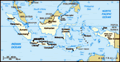
I was able to convince a new friend of mine to join me on vacation. Most of the newbies wanted to stay around Jakarta for the holidays and get more established before school started. Jakarta is a city with one of the largest populations in the world – certainly in Asia. During this Muslim holiday millions of people leave the city so it’s actually a great time to explore the local hot spots as the time you spend in traffic gets cut down in half. As tempting as it was to stick around, I figured I could experience the close destinations on weekends. I really wanted to get out of Jakarta and see a different part of Indonesia. There were three of us who traveled together. A girl I met here, but also her friend from University who got a teaching job with the same school as we did, but at a different location. We had talked about going away for a couple of days, but it wasn’t until Friday night that we booked a last minute ticket to Lombok and contacted a trekking company so we could hike Mount Rinjani – an active volcano on one of Indonesian’s
thousands of islands. Lombok Island is just east of Bali.
*Mount Rinjani or Gunung Rinjani is an active volcano in Indonesia on the island of Lombok. It rises to 3,726 m (12,224 ft), making it the second highest volcano in Indonesia. The first historical eruption occurred in September of 1847. The most recent eruption of Mount Rinjani was on 1 October 2004. The volcano and spectacular Segara Anak crater lake, are protected by a national park established in 1997. The 6 km by 8.5 km oval-shaped caldera is filled partially by a lake known as Segara Anak (approximately 2000m above sea level and estimated at being between 200m and 300m deep); the caldera also contains hot springs. The eruptions of 1994, 1995, and 1996 have formed a small cone, Gunung Baru (or Mountain New - approximately 2300m above sea level) in the center of the caldera and lava flows from these eruptions have entered the lake. The highlands are forest clad and mostly underdeveloped. The lowlands are highly cultivated. Rice, soybeans, coffee, tobacco, cotton, cinnamon, and vanilla are the major crops grown in the fertile soils of the island. Tourism is also increasingly popular with
trekkers able to visit the rim, make their way into the caldera or even to make the more arduous climb to the highest point, fatalities, however, are not uncommon.
*Taken from
http://rudytrekker.com/rinjani_information.htm We left Sunday afternoon for our adventure. We quickly learned that it’s best to catch a flight early in the morning here as flights are commonly pushed back and delayed up to several hours. Our flights were delayed a little but it wasn’t too bad. The trekking company we booked with were amazing and treated us like royalty! They picked us up from the airport Sunday night and brought us to a hotel they had arranged for us. The next morning they picked us up, fed us breakfast, and then we started hiking to our first destination. Since it was just the three of us, the owner put us with some other random people so that our group was a little bigger. It’s always a gamble when strangers come
together, but we lucked out! The four others were awesome. The seven of us hiked at roughly the same pace and we laughed lots which made for a good time. There were two Frenchies plus a married couple. The couple met here in Asia and are both currently teaching in Malaysia – she is originally from Florida and he was British. We now have a place to stay in Malaysia J There were many people climbing when we were – some groups were from the same company as we were with, but lots were not. It was fun meeting people from all over the world. There were a large number people hiking were from Quebec and France and even the French guys who were with us couldn’t figure that one out…..a popular destination among the French I suppose.
Day 01:Senaru Village-(Sembalun village 1.150.m) – Sembalun Crater Rim(2.639.m) We woke up early, had breakfast and drove about an hour from Senaru Village to where the trail head was. We started hiking from 1051M and after approximately four hours we stopped for lunch at 1800M. The porters prepared
all our meals, served us and carried all the very heavy gear. The food was tasty and the portions were HUGE. We all felt bad as they take the time to prepare and carry all this food, but you don’t want to overeat especially if you have a couple of hours yet to go in the day. A lot of the porters were chain smokers, they all wore flip flops and carried massive loads through the tough terrain – they were machines! I know they do it all the time and are more accustomed to the path than we were, but it’s not super easy for them…in fact, I saw some porters slip and drop their loads a few times. I asked our guides how often they hike this trail and they said two times a week – roughly seven times a month. It’s nearing the end of the peak season though as it starts in June and ends in August. The trail reopens every year in April and closes down in September/October sometime.
After lunch we continued to the Sembalun Crater Rim (Pelawangan Sembalun) at 2639M. The trail up to lunch was steep but it wasn’t
anything like what we were about to face. The next three hours were steep and in an open area (no tree cover). Luckily, low clouds rolled in which made it cooler for hiking. It was still humid of course, but more manageable than if it were clear and sunny. The trail did flatten out a little in the last hour as we approached the camp. From the Sembalun Crater Rim we can enjoy the awesome views and watched the sun set as the cloud cover was in the valley beneath us. We finished our meals as the sun was setting, star gazed for a bit and then quickly headed off to bed as we were to wake up at 2:30am for the three hour trek up the summit for the sunrise.
Youtube. � Day One: Camp and the Incredible view we had:
[
Day 02: Summit/Top 3.726m – Segara Anak Lake and Hotsprings (2008m)-Senaru Crater Rim(2.641m) We woke up at 2:30am, had a light breakfast and headed out shortly after with our headlamps on and warm clothing. The two other girls I was with didn’t want to be exhausted for the rest
of the day so they decided to opt out on this extra hike. They woke up at 2:30 still to enjoy some tea and part one of breakfast with us before heading back to the tents for more sleep. They woke up again at six to enjoy the sunrise from camp, but missed out on the views from the mountain top. The next three hours were the hardest. It was straight up….I mean STRAIGHT up. The path was a decent width across however the drop offs were extremely steep on both sides. The actual path was not friendly either – in fact, it was gravel the whole way up. As you took two steps forward, you took one step backwards. The guides warned us of this before we started, but it came to a point in the last few hundred meters where everyone on the mountain took a short break every couple of feet. It was exhausting but I was determined to reach the summit for the sunrise. It was of course totally rewarding and the views were incredible. From the summit, you can see all of Lombok Island, Bali, Sumbawa and Segara Anak Lake. After the sunrise we hiked
back down to the Sembalun Crater Rim, had our second breakfast, left the porters to clean/pack up and hiked down to the lake and hot springs. We stopped for lunch at the lake and swam in the hot springs with waterfalls around us. Not exactly a way to cool yourself down, but the clouds were rolling in again and it made it easier to last in the warm water. After lunch we continued hiking towards our second base camp on the Crater Rim of Senaru. Again we enjoyed a sunset dinner overlooking Mount. Agung in Bali, the smoke stack from the hole of the new volcano by the lake and the sun reflecting off the clouds. I was super excited to go to sleep that night and feel asleep immediately.
Youtube. Day Two: Hike down to Segara Anak Lake * The footage towards the end is not the greatest, but you may notice the monkeys if you look closely...at the end of the clip I zoom up on them, but they are nothing but one blur.
[
Youtube. Day Two: Camp
[
Youtube. Day Two: Sun Set with Bali
in the distance
[
Day 03: Senaru Crater Rim(2.641m) – Senaru Village (601m) After breakfast and enjoying the sunrise we hike for about five hours back down to Senaru Village where we got picked up and then transported to our next destination. It’s very popular for people to continue to the Gili Islands , but since we still needed to get a few things done before school we decided to come back and explore those islands another time. Instead, we finished our vacation off at a beach front resort in Senggigi. We relaxed by the pool and rested our very sore and stiff bodies. It was comical walking up and down stairs as we all looked like we were well into our 90’s! I do plan on getting my diving license here at the Gili Islands sometime soon – lots of people here have theirs and go diving all over .
Overall, the hike was challenging but the scenery was absolutely breathtaking! The trek to the summit was the most difficult. I tried to compare it to the Grouse Grind and without hesitation;
it makes the Grouse Grind seem like a piece of cake! It was much steeper and you’re climbing on gravel for three hours compared to a stair master for an hour.
It was nice to get away for a few days but it was also good to have time yet before the school year began.
Advertisement
Tot: 0.127s; Tpl: 0.014s; cc: 13; qc: 29; dbt: 0.0602s; 1; m:domysql w:travelblog (10.17.0.13); sld: 1;
; mem: 1.2mb


Angela
non-member comment
Great Adventure
Hi Janice, Thanks for telling us about your first travel adventure. You sure didn\'t waste time to begin exploring that part of the world. It\'s fun seeing another part of the world through your words and pictures. All the best as school begins. I hope you can settle into a great routine and really enjoy the kids you teach. Blessings,