Libyan Geography, Libya Geography
Advertisement
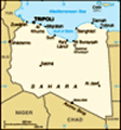
Location: Northern Africa, bordering the Mediterranean Sea, between Egypt and Tunisia
Geographic coordinates: 25 00 N, 17 00 E
Map references: Africa
Area: Total: 1,759,540 sq km land: 1,759,540 sq km water: 0 sq km
Area - comparative: Slightly larger than Alaska
Land boundaries: Total: 4,348 km border countries: Algeria 982 km, Chad 1,055 km, Egypt 1,115 km, Niger 354 km, Sudan 383 km, Tunisia 459 km
Coastline: 1,770 km
Maritime claims: Territorial sea: 12 nm note: Gulf of Sidra closing line - 32 degrees, 30 minutes north
Climate: Mediterranean along coast; dry, extreme desert interior
Terrain: Mostly barren, flat to undulating plains, plateaus, depressions
Elevation extremes: Lowest point: Sabkhat Ghuzayyil -47 m highest point: Bikku Bitti 2,267 m
Natural resources: Petroleum, natural gas, gypsum
Land use: Arable land: 1.03% permanent crops: 0.19% other: 98.78% (2001)
Irrigated land: 4,700 sq km (1998 est.)
Natural hazards: Hot, dry, dust-laden ghibli is a southern wind lasting one to four days in spring and fall; dust storms, sandstorms
Environment - current issues: Desertification; very limited natural fresh water resources; the Great Manmade River Project, the largest water development scheme in the world, is being built to bring water from large aquifers under the Sahara to coastal cities
Environment - international agreements: Party to: Biodiversity, Climate Change, Desertification, Endangered Species, Hazardous Wastes, Marine Dumping, Ozone Layer Protection signed, but not ratified: Law of the Sea
Geography - note: More than 90% of the country is desert or semidesert
Advertisement
The information here has been derived from Public Domain Sources such as the CIA World Factbook. No liability can be taken for any inaccuracies.
Tot: 0.062s; Tpl: 0.008s; cc: 6; qc: 6; dbt: 0.0168s; 1; m:domysql w:travelblog (10.17.0.13); sld: 1;
; mem: 1.1mb
 From the earliest days of his rule following his 1969 military coup, Col. Muammar Abu Minyar al-QADHAFI has espoused his own political system, the Third Universal Theory. The system is a combination of socialism and Islam derived in part from tribal ...