Advertisement
Published: April 16th 2009

 St. Maarten
View from the capital of Dutch St. Maarten, St. PhilipsburgEASTERN CARIBBEAN CRUISE January 10 - 17, 2009
Our first foray of 2009 was a delightful cruise on the Celebrity Summit to five islands in the eastern Caribbean: St. Martin/St. Maarten, Dominica, Grenada, Bonaire, and Aruba. A four-hour, first-class Continental flight took us to San Juan, Puerto Rico, the departure port for the cruise.
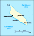
Early the next morning, we arrived in St. Martin/St. Maarten, nicknamed “The Friendly Isle.” This dual-nation island is part of the Lesser Antilles islands and is only 37 square miles in size (roughly the size of Washington, DC). The divided island is the world’s smallest territory shared by two sovereign states. In the early 1600’s both the Dutch and the French established small settlements on the island and decided to share the island and fight together to prevent a Spanish invasion. According to local folklore, the island was divided by a walking contest between a Dutchman and a Frenchman, resulting in Dutch control of 16 square miles and the remaining 21 under French sovereignty. St. Maarten (pronounced sint-MARE-ten) is ruled by the Dutch, and St. Martin (pronounced san-mar-TAN) is under French control. The partition is friendly, but they are definitely two different countries. For example, it
St. Martin
Capital of French St. Martin, Marigot is an international call to phone from one side of the island to the other. However, there are no border patrols or visas required, and the only indication of crossing a border is a small sign.
The ship docked in the Dutch capital of Philipsburg, St. Maarten, where we began our island tour with a drive through this bustling town of duty-free shops, casinos, and bars. After a photo stop for a spectacular view of beaches and islands, including St. Barts in the distance, we soon crossed the border of the two countries, with nothing but a sign to signify the difference at this point. However, the French atmosphere soon became apparent as we stopped for an hour of shopping in the French capital of Marigot, a quaint, quiet, secluded town only four streets wide and emanating the romance and ambiance of a small French village with its gingerbread houses and sidewalk bistros. Continuing our circle around the island, we passed Grand Case, a small but picturesque fishing village on the northern tip, and stopped at a scenic lookout over the lush landscape of verdant rolling hills on one side, and beautiful sandy beaches and placid lagoons on the other.
Dominican Rainforest
View from the gondola of the suspension bridge 300 feet over the river gorge As we returned to the ship, we remarked how the two life-styles are different yet charming vignettes of their respective homelands, co-existing in harmonious contrast.
The next day was Monday, January 12, 2009, and we docked in Roseau, Dominica at 7 a.m. We had eagerly looked forward to today’s excursion, an aerial tram journey into the Dominican rainforest, but we had not anticipated just how spectacular it would be. We tend to see the Caribbean as all white sand, swaying palms, and dark rum, but there is so much more than that to this island beyond the shoreline. Dominica hides a world of delightful surprises and dramatically defies Caribbean stereotypes.
We drove about thirty minutes through the Roseau Valley to the base station of the Rainforest Aerial Tram. The dormant volcano that formed the island has left deposits of rich soil, upon which a vividly lush rainforest grows. Six of us and our guide climbed into a gondola that slowly and noiselessly ascended from the forest floor, emerging through the canopy, for an extraordinary sight—a 360-degree panorama of verdant, pristine forest, surrounded by blue water in the distance nearly 2,000 feet below. As we glided, suspended 100 feet above
the forest floor, the hush was so overwhelming that we could hear the sound of birds skittering from branch to branch and the wind whispering through the trees. It was like being in a comfortable and serene cocoon. (It was a very different way to experience nature from the ziplining we did through the Costa Rican canopy, where we couldn’t really enjoy the views as we held on for dear life, and where screams of fear and delight broke the silence of the rainforest.)
As we reached the end station at the top, we left the tram and hiked a nature trail back down the mountain for about thirty minutes. We crossed 300 feet above the Breakfast River gorge on an 84-meter suspension bridge from which we observed four different waterfalls. We then re-joined the tram, returning to the base station, where refreshing rum punches awaited us.
The rest of the day was spent relaxing on the deck of the ship, as we were “entertained” by several rainbows, including two different double rainbows that seemed to form a “handle” over the island. The rainbows were formed from the afternoon showers over the rainforest and were fascinating to watch.
The “Isle
On the suspension bridge in the Dominican rainforest
The bridge spans 84 meters 300 feet over the Breakfast river gorge of Spice” was our next destination, and the very air was a pleasure as it carried the fragrance of cinnamon, nutmeg, ginger, cloves, mace, and other spices wafting in the balmy air as we docked in beautiful St. George, Grenada, on Tuesday, January 13, 2009. Having visited Grenada before, we knew we would have an enjoyable day in this lush, tropical island best known for the political turmoil of 1983 when U.S. troops had to intervene (and Clint Eastwood made a movie about it!).
St. George may be the most picturesque Caribbean port, situated on a beautiful deep harbor which was formed in an extinct volcanic crater. Pastel warehouses dot the shore, and neat houses painted in every color of the rainbow rise above the harbor and disappear into the green hills. All buildings are made of brick or lava because wood is forbidden as a fire hazard.
Our excursion stopped first at Fort Frederick, perched atop a hill in the center of the city, from where we had world-class views in every direction, including the Caribbean on one side and the Atlantic Ocean on the other. Our next stop was at a beautiful black sand beach, where the sand,
made of volcanic remnants, felt very soft and inviting.
We continued up the east side of the island and then turned inland, driving through plantations of cashew, cocoa, nutmeg, cinnamon, ginger, clove, and mace. Our driver stopped and hopped out of the van several times to pick some samples of the spices for us to smell, feel, and taste. Finally, we arrived at the Grand Etang Nature Park, high in the mountains of the island’s interior. The rainforest in the reserve holds a rich diversity of flora and fauna around the azure waters of Grand Etang Lake, which fills the crater of an extinct volcano. The land is rugged and mountainous, with fragrant spice, mahogany, and pommier trees rising above ferns, wild nutmeg, heliconia, and ginger lilies. Absolutely beautiful!
We then left the reserve and descended to Annadale, where a short but steep walk brought us to the Annadale Waterfall, a thunderous 40-foot waterfall hidden among lush vegetation. We were back at the ship by early afternoon, in time to attend an elegant “high tea” for members of the Captain’s Club.
The next morning was taken up with an enjoyable backstage theater tour by one of the performers, followed by
Cocoa
Cocoa plantation on the "Isle of spice" our arrival into the island of Bonaire. This was our first visit to this relatively-unknown island, part of the ABC chain of islands—Aruba, Bonaire, and Curacao. There are only about 60,000 visitors annually, and half of them are divers who come for some of the best diving and snorkeling in the world in the protected reefs around the island. Bonaire is a pristine paradise with a population of 10,000 people and 15,000 flamingoes. This time of year, most of the flamingoes nest on the salt flats surrounding the island. Cows, goats, sheep, pigs, donkeys, and horses have wandered freely on the island since they were introduced in 1526, and they are considered to be Bonaire’s “wildlife.” We saw many roaming around as we traveled the island.
From the capital, Kralendijk, a beautiful stretch of road leading north wound past dazzling blue water on one side and soaring coral cliffs on the other. The rustic northern coastline is an impressive assortment of dramatic scenery. Goto Lake is one of the most beautiful places on the island and is where we spotted some flamingoes feeding. We stopped at Washington National Park, a nature sanctuary on the northeast side of the island, and
visited the museum and the open-air cultural center. Near the park’s exit is the village of Rincon, the only other “town” on the island besides the capital. It was founded by the Spanish around 1499 to house slaves, and today the town is an entrancing collage of pastel cottages.
We turned inland and rode some bumpy dirt roads to the top of 403-foot Seru Largu, a hill overlooking Bonaire with a glorious vantage point of southern Bonaire, the salt pans on Salt Lake where the flamingoes nest; the capital city of Kralendijk; our ship in port; and, nestled in Bonaire’s western crescent, the uninhabited islet of Klein Bonaire. Also at the top of the hill is a large, bright yellow-and-white monument titled “Towards Heaven,” which was built from funds raised by the local Catholic Church in 2000. Although there is a hint of development and tourism on Bonaire, I hope it remains unspoiled for a long time.
Bonbini! This was our greeting in the native language of Papiamento the next day, January 15, 2009, as we arrived in Aruba, whose motto is “One Happy Island.” Bill and I had been to Aruba twice before, but the island is so different
from other Caribbean islands that we were happy to be back. The topography and vegetation of Aruba are unusual for a Caribbean island. On the south and west coasts are miles of beautiful white beaches, rimmed by calm, multi-hued blue seas, with visibility up to 100 feet. The island’s most famous trees are the watapana, or divi-divi trees, all gracefully bending south with the constant trade winds. The northeast coast along the Atlantic is rugged and wild, while the interior is desert-like, with cacti and dramatic rock formations. In fact, 60% of the island is covered with cactus. There is no soil—just rock consisting of granite and coral.
Our tour began in the picturesque capital of Aruba, the schoonerharbor of Oranjestad. There were outdoor markets displaying tropical fruit, local crafts, and gabled, colorful buildings typifying the early days of Aruba. Our first stop was the Casibari Rock Formations, a unique geological site on Aruba, where trade winds have eroded boulders into magnificent formations. We climbed one of the huge formations and had a spectacular view of the Aruba landscape, including Haystack Mountain, standing over 500 feet high in the very center of the island. There are over 1,000 uneven “steps”
that you can climb to the top, which I have done on a previous trip and have no desire to repeat!
Our next stop was Aruba’s famous Aloe Factory, where we took a short tour and learned interesting facts about aloe farming, production, and uses. We had a chance to shop, and I bought several tubes of creamy aloe lotion. We then traveled along the rugged windward side of the island to the spot where one of the most famous tourist attractions—the Natural Bridge—had once been. There are seven natural bridges in Aruba, but this one was the biggest, centuries-old, and the most famous; however, it collapsed in 2005, leaving a pile of rubble in the bay. Fortunately, the collapse occurred around 3 a.m., when no tourists were standing on it. It was quite a disappointment to see it reduced to rubble, but at least we have the memories of it from earlier trips. There still remains a smaller bridge next to the fallen bridge. All of the bridges were sculpted from rock over centuries by the powerful forces of the wind and sea.
We learned a bit about the culture that we had not picked up in our previous
visits. For example, we didn’t know that a man had to build himself a house before he could begin dating a woman seriously. Also, more than 75% of the population was born on the island. Finally, a short stop at one of Aruba’s many beautiful white-sand beaches completed our tour, and we spent the rest of the day enjoying the varying shades of blue water from our stateroom balcony on the Summit.
The next day was Friday, a day at sea, and among our activities were attending a computer class exploring “Websites You Should Know,” the Senior Officer’s Cocktail Party, and of course, more blackjack! Bill has been extremely lucky on this trip and has won the most money he has ever won on a cruise. He started with $50 and ended with $394, for net winnings of $344!
We knew in advance that it would be a fabulous cruise, as Celebrity is our favorite cruise line and the Summit is one of our favorite ships. They didn’t let us down! The food was fantastic, and the entertainment was top-notch, especially David Deeble, the comedy juggler, and pianist Antonio Salci. Our stateroom and balcony were large by cruise ship standards,
and the crew was delightful. Of course, the mild temperature of the Caribbean was fantastic, too; it ranged from 76 to about 82 every day. All in all, the experience was a “10” and we recommend it highly.
Advertisement
Tot: 0.19s; Tpl: 0.015s; cc: 12; qc: 75; dbt: 0.0895s; 1; m:domysql w:travelblog (10.17.0.13); sld: 1;
; mem: 1.3mb


Lois Pickens
non-member comment
location
Very pretty and different scene , but where on the Island is it located? If I get off a Cruise ship can I get to you fast? Where are all the black sand beaches? Thanks