Malagasy Geography, Madagascar Geography
Advertisement
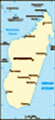
Location: Southern Africa, island in the Indian Ocean, east of Mozambique
Geographic coordinates: 20 00 S, 47 00 E
Map references: Africa
Area: Total: 587,040 sq km land: 581,540 sq km water: 5,500 sq km
Area - comparative: Slightly less than twice the size of Arizona
Land boundaries: 0 km
Coastline: 4,828 km
Maritime claims: Territorial sea: 12 nm contiguous zone: 24 nm exclusive economic zone: 200 nm continental shelf: 200 nm or 100 nm from the 2,500-m deep isobath
Climate: Tropical along coast, temperate inland, arid in south
Terrain: Narrow coastal plain, high plateau and mountains in center
Elevation extremes: Lowest point: Indian Ocean 0 m highest point: Maromokotro 2,876 m
Natural resources: Graphite, chromite, coal, bauxite, salt, quartz, tar sands, semiprecious stones, mica, fish, hydropower
Land use: Arable land: 5.07% permanent crops: 1.03% other: 93.91% (2001)
Irrigated land: 10,900 sq km (2000 est.)
Natural hazards: Periodic cyclones, drought, and locust infestation
Environment - current issues: Soil erosion results from deforestation and overgrazing; desertification; surface water contaminated with raw sewage and other organic wastes; several species of flora and fauna unique to the island are endangered
Environment - international agreements: Party to: Biodiversity, Climate Change, Climate Change-Kyoto Protocol, Desertification, Endangered Species, Hazardous Wastes, Law of the Sea, Marine Life Conservation, Ozone Layer Protection, Wetlands signed, but not ratified: none of the selected agreements
Geography - note: World's fourth-largest island; strategic location along Mozambique Channel
Advertisement
The information here has been derived from Public Domain Sources such as the CIA World Factbook. No liability can be taken for any inaccuracies.
Tot: 0.042s; Tpl: 0.007s; cc: 5; qc: 8; dbt: 0.0116s; 1; m:domysql w:travelblog (10.17.0.13); sld: 1;
; mem: 1.1mb
 Formerly an independent kingdom, Madagascar became a French colony in 1896, but regained its independence in 1960. During 1992-93, free presidential and National Assembly elections were held, ending 17 years of single-party rule. In 1997, in the seco...