Advertisement
Published: March 27th 2009

This is a different type of trip report, since it covers an urban wilderness hike. And although I hiked in the midst of a couple million people (almost all on my left, with the Atlantic on my right), the hike doesn’t make me an
urban explorer and the adventure isn't quite up to a feature in
jinx magazine; there were neither catacombs nor sewers on this backpack. Just the beach, mostly urban (with a few liquid gaps,) heading north up the
Gold Coast.
 Photos are by Kevon Andersen taken on this hike unless noted. The six photos that were taken during practice hikes are noted with "(ph)" in the cutline.
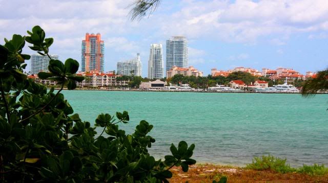
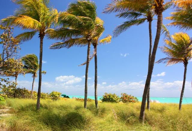
The scenery was beautiful from the start. The hike began at the lighthouse in
Bill Baggs State Park at the southern tip of Key Biscayne, then island hopped to Virginia Key before a
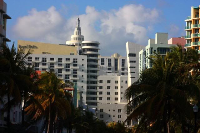
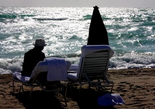
long detour through downtown Miami to Miami Beach. I camped on the sand at
South Beach to complete what became an 18.5 mile day. And despite my exhaustion, I was rousted out of my tent by four-wheelin' Miami Beach policemen at 2:30 a.m., but I'll tell more about that later, at the end of Day One.
The second morning I headed north on the sand up Miami Beach, past Surfside and Bal Harbour, arriving at the bridge over
Haulover Inlet by noon, and I knew then I could finish the hike that day, since Haulover park was to have been the second-night camp spot of what was to be a 3-day hike. So I plodded on through
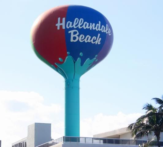
Sunny Isles, eventually crossing the Broward County line. Then past Golden Beach, Hallandale Beach and
Hollywood. Once through Dania Beach, I arrived at sunset at my terminus,
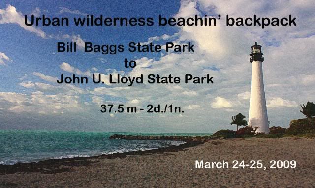
John U. Lloyd State Park across from Port Everglades, end of a 19-mile day. Total trip was 37.5 miles.
The reward: Two days and a night of breathing that fresh unfettered air wafting in off those turquoise waters of the Atlantic.
But this was more than just soaking in some sun and sights while walking, for the hike gave me time to step out of that crazy Miami hub-bub and take a much better look at the place I’ve somewhat begrudgingly called home for the past 20 years (this May.) When I came in off this surfside trail both sunburnt and foot-sore, I realized that I had learned something.
Prep:
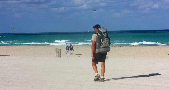
My
base weight for the hike was just under 10 pounds. I was trying out some new gear, including a
sandals-for-sand system recommended by BarryP from my
ultralight backpacking forum. I wore a new DSLR hands-free "keyhole" camera retainer. And since I’m a longtime Type I diabetic, I was using a radical new toy, a
CGM or Continuous Glucose Monitor that records blood-sugar levels every 5 minutes on a small, light bluetooth PDA that I usually kept hooked to the belt strap of my hiking shorts.
(If you’re a diabetic or know one, you can read more about this item in the Health and Safety topic of the forum.) Total weight for the pack with food, water, clothing and other essentials was 29 pounds.
And in keeping with my commitment to eat healthier since I ended my early retirement and started working at an organic grocery store a few months ago, I tried to consume only organic or natural foods, and made healthier, home-prepared foods using Sarah Svien
Kirkconnell's Freezer Bag Cooking method. It worked out well. (A gear and food list will eventually follow at the end of this entry.)
The Hike:
So here in pix (with a few stories) is a chronicle of the hike.
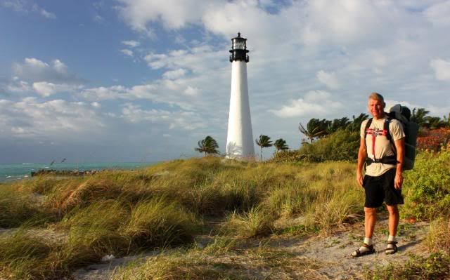 Hike's start: The southern tip of Key Biscayne in Bill Baggs State Park. That is the Cape Florida lighthouse in the background, first lit on December 17, 1825. Note the keyhole camera gizmo that replaced the sternum strap on my backpack. Photo by Debbie.)
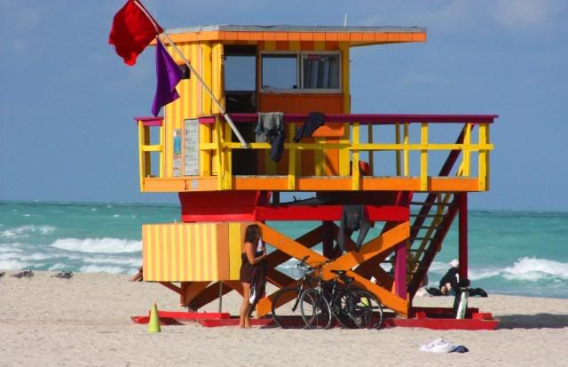
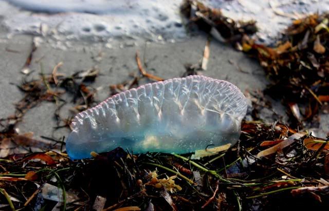 Portuguese Man 'O War. One of the thousands on the beach on the hike, and the reason for the purple flags at lifeguard stands to go with the red "rip current" ones. These stinging jellyfish inflate as a means of wind propulsion, virtually "sailing along." I inadvertantly stepped on one early in the hike, causing a loud pop that had me searching for who would be shooting at me so soon into the walk.
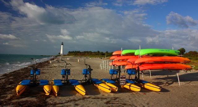 Aquatic wares of the concessionaires, Bill Baggs State Park, the lighthouse fading into the background.
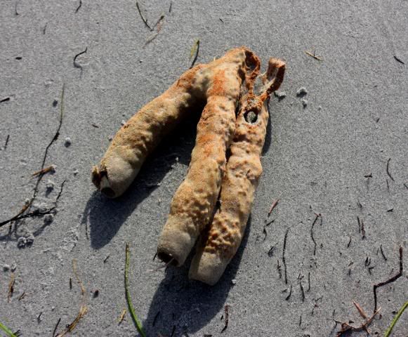 Soft coral washed ashore at Bill Baggs SP from either the inner and outer reefs of Hawk Channel offshore. The outer reef running alongside the Florida Keys ends just north of here.
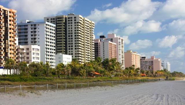
 Civilization! Leaving the state park and entering the Village of Key Biscayne (that was hosting the Sony-Ericson tennis tournament as I walked by.) Despite the beachfront highrises, the quaint little village behind them, surrounded to the north and south by large parks, still allows residents to travel the roads on "street-legal" golf carts. Many of the residents are ex-pats from South and Central America, and most are quite wealthy.
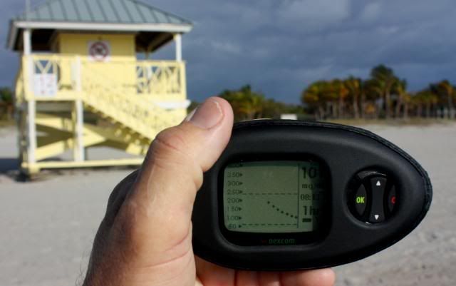
Not a cellphone, but my new CGM PDA showing my glucose level every five minutes as a method for diabetic control. The glucose level is transmitted by a tiny probe taped to my waist above my hip belt. It worked great on this trip.
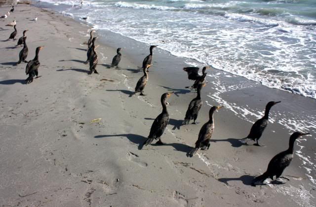
Flock of Double-Crested Cormorants not budging on the beach at Crandon Park.
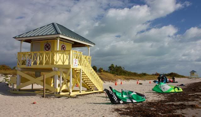
Having encountered only a few joggers on the beach in the strong winds, I came upon a contingent of kiteboarders at their usual spot on the north end of Crandon Park. Perfect conditions -- strong onshore winds -- for them.
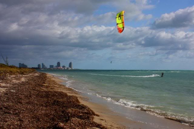
Kiteboarder off the northern tip of Key Biscayne, with the highrise condos of South Beach on the horizon. I had to divert inland here into Bear Cut Preserve, to prevent walking on the protected fossilized coral beds on the island's northern tip.
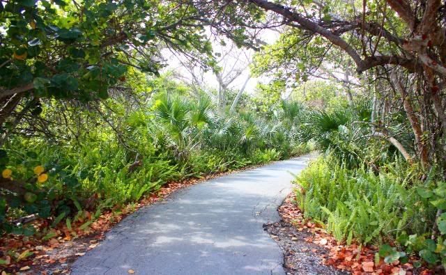
On the bike path in Bear Cut Preserve, what had been my jogging path until I switched to walking with a training pack at the first of this year. Parts of this trail are very scenic and wild. They call this area a "hammock," not to be confused with what many of my UL-hiking compadres sleep in. (ph)
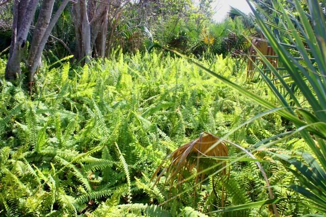
The green undercover provided by ferns, cabbage palm, strangler figs, poisonwoods in the preserve. The nearby Crandon Park Nature Center, a rare conservation-oriented jewel in Miami, oversees this park so close to Miami's millions. (ph)
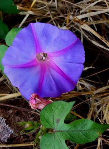
Morning glory flower (from the vine) in the preserve.
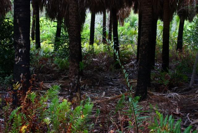
Scorched palms from a recent wildfire in the preserve. I encountered one snake on the trail, a 4-foot racer sunning itself on the path. Crandon Park is also home to exotic iguanas, some as long as six-feet.
Exiting Bear Cut Preserve, I crossed Crandon Boulevard and headed past Crandon Marina for Bear Cut Bridge. I stopped and talked to a boating neighbor on his bike before moving on. To keep from being a hiking hypocrit with a Sierra Club patch on his backpack, I carried a discarded bucket and a roll of carpet remnant pulled off the bike route over the bridge and deposited them in a trashcan out front of the UM Marine Science building. Then it was into the recently re-dedicated, historic park on Virginia Key.
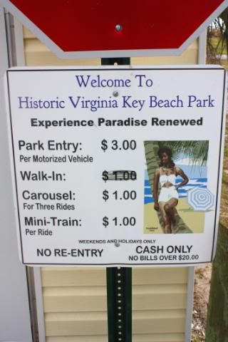
Entrance to the new Virginia Key Beach Park. (Note: I did NOT have a magic marker on me to avoid paying!)
Virginia Key wasn't an island until the Great Hurricane of 1835. A new cut, called Narrows Cut, broke through during the storm, and the island was named Virginia Key by the surveyor Frederick Gerdes in 1849.
So how is this park historic?
In my lifetime, up until I was about 10 or so (the early 1960s), African Americans were deemed unworthy to play on the beach with vacationing white folks. It was illegal for them to stroll the sand on Miami Beach, and the unwritten law was to be off that barrier island (unless one was a servant) at sundown.
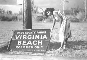
Historic photo from the 1950s of the segregated beach on Virginia Key. From a Dade County collection.
So the powers that be relegated the black citizens of the county to the beach on Virginia Key, accessible by a long ride and a bascule bridge. It's a pretty beach, but a nasty current flows past in Bear Cut and they have signs all over permanently prohibiting swimming. So much for that old "separate but equal" idea.
When segregation lost its legal status, developers circled like vultures over Virginia Key, hoping to condo-ize it. But the empowered black community, along with the fact that a sewage treatment plant was the beach's neighbor, forestalled development, and only now is the restored park "safe" from encroaching urbanization. (But let's be truthful, NOTHING in Miami-Dade is ever really "safe" from development.)
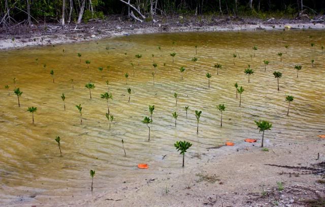
Planted mangroves at VKBP. The Sierra Club has an ongoing native-plant restoration project on the Key (that I plan to get involved in.)
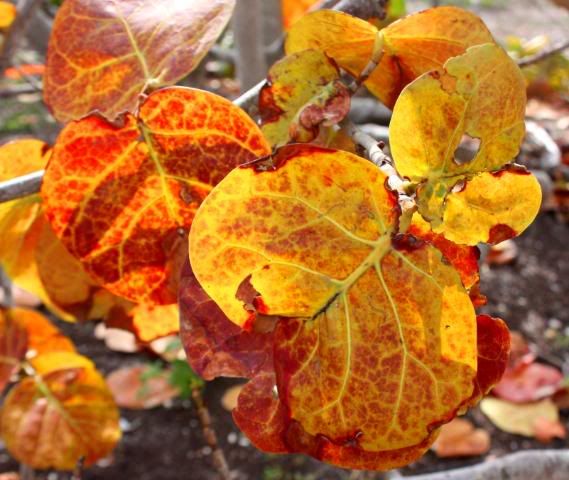
Sea grape tree in VKBP. The fruit from these trees is edible. The leaves are orange/red since we're in the dry season.
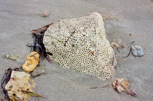
Chunk of coral on the beach at Virginia Key.
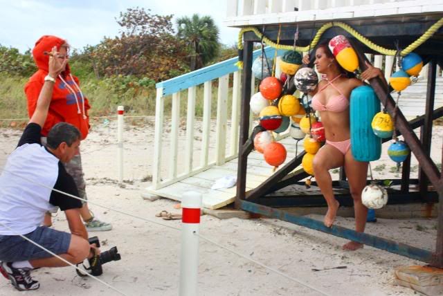
I must be getting close to Jimbo's! First of the trek's photo-shoots spotted at the lifeguard stand on Virginia Key.
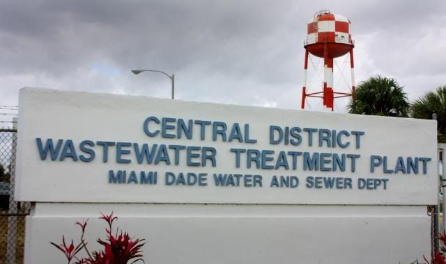
Now I know I'm near Jimbo's! The sewage treatment plant on Virginia Key has probably done more than anything in preventing development on this beachfront land.
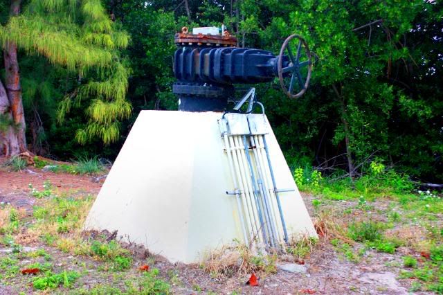
What's this? It isn't the shut-off valve for the big pipe that takes the screened, barely treated sewage from the millions of landside Miamians and pumps it the "legal" limit offshore in the Gulf Stream? See the local news story about this pipe and the string of others up the Gold Coast that pump this brown cloud into the ocean, and about efforts to stop it.
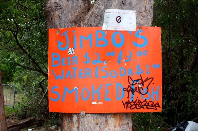
Sign for the incredible, unique Jimbo's, across from the sewage treatment plant. Last bastion of Crackerdom. (And beer prices half what they are 2 miles to the north on South Beach. And the ambience -- priceless!)
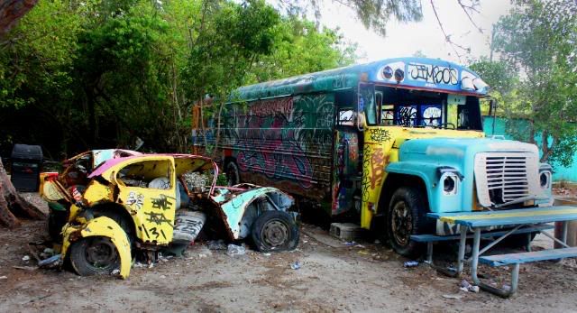
Yard art at Jimbo's, possibly the strangest place in Miami, and that's saying alot.

Inside Jimbo's magic bus. Photo taken by a young guy who called himself "Wolfgang, the surfer."
Jimbo and his ramshackle bar are literal burrs in the ass of succeeding waves of county commissioners who want (or whose developer-friends want) that waterfront land. But he has an ironclad contract so they have to leave him alone. The place has been used in many TV shows and movies to show "Old Florida," including several espisodes of that 1980s "Miami Vice" show. Each April friends buy dozens of kegs to celebrate Jimbo's birthday (83, no 82, no, the guys sipping beer around the rusty fire barrel weren't sure.)
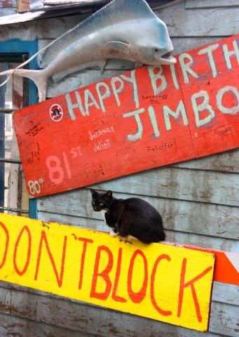
A Jimbo cat.
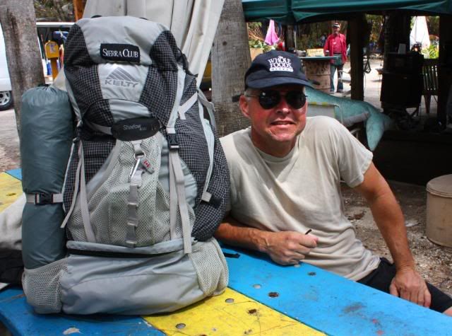
Resting on the "veranda" at Jimbo's, with backpack and WFM hat, 7.5 miles into the hike. (Photo by Debbie.)
Looking north at Narrows Cut, with the exclusive Fisher Island and its megayachts in the foreground, SoBe's highrise condos behind. Time for the big detour.
Leaving Jimbo's, I headed to Virginia Key's northern end, where the plan had been to have Debbie in our inflatable dinghy (with outboard) take me over to Fisher, a "private" island innaccessible to common folk (unless invited, then you take the ferry from Miami Beach.) The land is private EXCEPT for the sand up to the high tide line which is "open" to the public by Florida's public beach access law.
My plan was to have Debbie drop me off in the dinghy D-Day-like to hike the beach up to Government Cut, where I'd swim out (without the pack, still in the dinghy) for the ride over to South Beach. But the wind and waves from the 20-knot winds were too much for the dinghy and to be able to get ashore.
So I added 10 miles to the hike by walking around: Over the Rickenbacker Causeway, up Brickell, through downtown Miami and over the MacArthur Causeway back into South Beach, making it almost a 20-mile day. I stopped for lunch (bagel and foil packet of tuna) and for the briefest of protests at a Killer Whale's version of Guantanamo before resuming the walk.
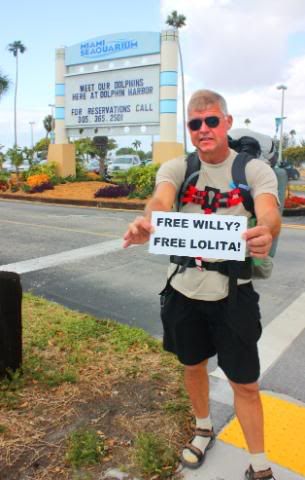
On the Hobie Beach leg of the hike toward downtown Miami. A short protest at Miami Seaquarium over the continued confinement of the Orca, Lolita. (Photo by Debbie.)
Lolita
For almost 40 years, the captive Orca at Miami Seaquarium has been making money for the amusement park -- and the city. In 1970, she and her pod were captured in Puget Sound when even then we should have known better. The survivors of the capture were sent off to spend their lives in the confinement of tanks to entertain us; for that we give them food.
The packed parking lot represents tourist dollars flowing into Miami, so only the park's highly publicized rescue and treatment of a manatee run down by a speeding boat makes the news here. A few years ago a big stink did erupt when a tourist made a video showing the decrepit state of the park -- rusty railings and the like, and they spent some money on paint and fixing a few of the problems.
Lolita, though, remains in her tiny tank. Because of her age, any thoughts of releasing her does create a quandary. But if they keep her confined for her safety, perhaps they could at least buy the rights to the name of the documentary and change her role and exhibition to an educational one, calling it: "Lolita: Slave to Entertainment."
To read more about Lolita, see the site on the documentary, or read about the continuing efforts to free Lolita.
From Hobie Beach, I said bye to Debbie and headed for the Rickenbacker Causeway, highest point of the trek. That is Brickell Avenue behind it.
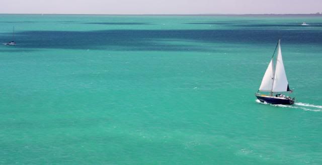
Sailboat cruising out from under the bridge into Biscayne Bay.
From the Rickenbacker, looking NW toward downtown Miami. Photo taken on a training hike in January (ph). Most of the buildings here have been built in the past seven years.
On south Brickell Avenue, one of my favorite streets in Miami. So different from what's happened in the recent condo-craze near downtown.
Heading up the south end of Brickell Avenue, I was treated to shade from the giant banyan trees overhead. The condos here were built a decade or two (or more) ago, and have decent-sized setbacks, adequate space between towers, superb landscaping, even coral rock walls with the roots of the banyan wrapped around them:
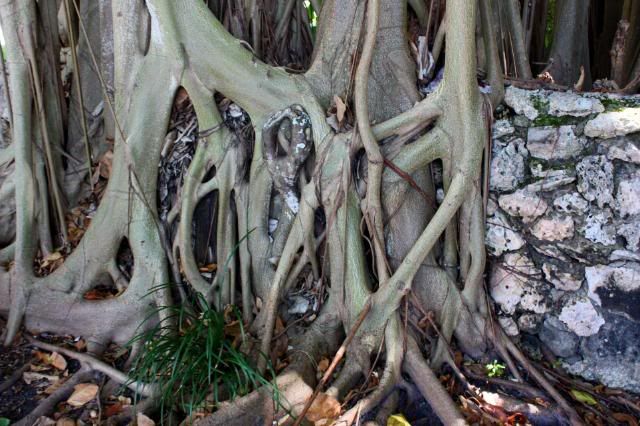
Coral rock and banyan tree, lower Brickell.
The Santa Maria, completed in 1997, and last of Brickell's thought-out residences before the condo frenzy began.
Moving up Brickell toward downtown, the shere density of the development is overwhelming.
What's happened this decade is unfathomable. Virtually any project submitted to the City of Miami received rubber-stamp approval. In 2005-2006 there were more than 70 high-rise cranes building condo towers in the downtown Miami area. Almost every week there was kick-off party overflowing with vintage Champagne and catered food celebrating the latest line of sheep ready to put 20 percent down on a sure thing. I've often wondered if Miami politicos EVER had to buy their dinner or wine during this frenzy.
And they're still building! Granted, there are a few abandoned foundation holes with protruding, rusting rebar downtown; they should turn one into a park and name it, "The Mayor Manny Diaz Monument," for the man was head cheerleader for -- not the one who could have reigned in -- the developers. He and the commissioners weren't asleep at the wheel, they were driving the boom bus. (The 'monument' refers to the famous Kliban cartoon, "The Nixon Monument.")
But they've still got dozens of buildings in various stages of completion that will only add to the glut. As of this January, there were tens of thousands of condos for sale in the downtown area, with many more taken off the market simply because it's impossible to get a decent price.
The quality of the construction during the frenzy is already suspect. At the height of the boom, a huge workforce of illegal aliens -- Guatemalans, Mexicans, Salvadorans -- were hired because they were illegal and they were CHEAP. Now with the construction waning, many are out of work and have headed home. (Remember: their number does NOT make it in the unemployment statistics.) And what they've left behind are some tacky condo towers blocking each other's views not of the ocean -- that's miles away -- but of either the squalid Miami River, of a bit of brown bay -- or of themselves.
The lack of foresight is epitomized by a pair of towers forming an "L" on the Miami River at 2nd Ave. a half-mile west of Brickell. They are the 44-story Latitude On The River and the 36-story Neo Vertika. To the north, the "riverside" view looks out on a transformer station for Florida Power and Light. To the south, inside the "L," the developers built a 30-story office tower, so that the condo residents can step out on their balconies and see a live, 3-D version of "The Office" just a few yards away.
Those downtown towers are built so willy-nilly with each elbowing the other for a peep-hole view, that a prospective buyer would need to be either a voyeur or an exhibitionist to buy, but then probably many of them are. Wait, that's not true: Almost everyone who bought a high-rise condo in downtown Miami bought it to flip it during that insane spiral of prices earlier in the decade.
The epitomy of the frenzy is appropriately named the Icon Brickell (or simply Icon,) a monument to Jorge Perez, a developer who played a key role in the overdevelopment. Jorge built his Icon, and it may just prove to be his undoing, as told in a March, '09 real-estate story in the NY Times titled, Miami Condo Colossus Is Monument to Excess." That's The First Presbyterian Church on Brickell dwarfed in the foreground. This project alone has 1,646 condos. Unbelievable.
Don't like the Icon? There's thousands of new condos across the river, including the 447 units at Met One on the right, where Brickell has turned into Biscayne. Interesting footnote: Water was ten feet deep in downtown Miami after the Great 1926 Hurricane.
The statue of the Te Questa Indian on the restored Brickell Bridge over the Miami River, with the Epic condo tower looming overhead.
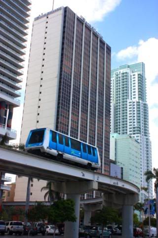 The Metromover, elevated mass transit, with a new condo tower behind on the right. The Metromover is a nice pearl in this bed of oysters called downtown. And it's free, too.
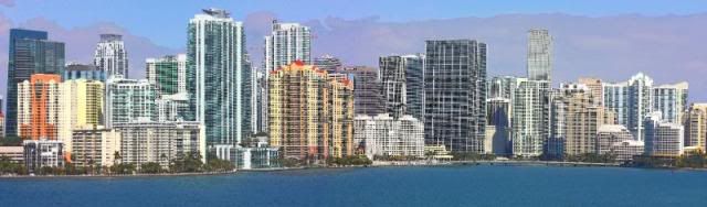
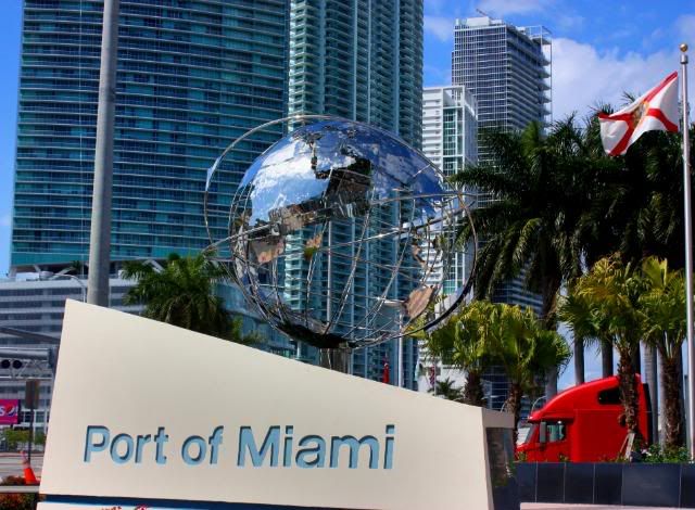 Entrance to the Dodge Island bridge and the Port of Miami, with four monstrous new condo towers behind: From left to right, Marina Blue, 900 Biscayne Bay, Ten Museum Park and Marquis, a total of 1,748 new condo units between them. Note the bright-red semi-truck on the right.
With the easy money from the condo-craze drying up, the developers and the politicos in their pockets have turned to tax money to feed their next get-rich-quick scheme. They've pushed through a new stadium for the attendance-poor
Florida Marlins (400 in their seats at a game last summer), where the taxpayers pay for a $625-million stadium and the Marlins, investing almost nothing, get a sweetheart deal on the profits. They're also pushing for a tunnel under Government Cut to divert the container trucks from lumbering through downtown, as seen in the photo above. And if you thought Boston's Big Dig was a financial fiasco, wait until you see a Miami-Dade project that requires them to build something below sea level
and keep the water out, since they've never figured out how to stop the roof leaks in a heavy rain at
Miami International Airport.
Apparently the cost overruns and unexpectedly high maintenance fees of the performing arts center project a few blocks away hasn't discouraged them, even though Carnival Cruise Lines bailed out on their "naming rights" to that sinking boat, and the county continues to lose its
Arsht on the center.
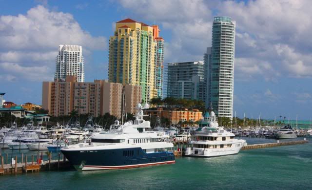 After the long, hot trudge over whatever they've currently named the island that the Miami Yacht Club and that parrot-amusement thing sit on, I walked the causeway over the bridge into South Beach, keeping an eye out for speeding Bentleys. There were only a couple of multi-million-dollar yachts at the Miami Beach Marina, since "season" is almost over.
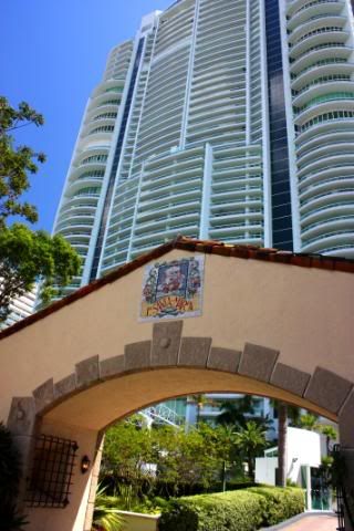
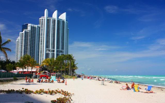
 The Portofino Tower, my favorite condo tower -- simply because of its uniqueness. It was built in 1997, before the insanity began, is 44 stories and has 206 units. Here it overlooks the nicely redone South Pointe Park (re-opened a week earlier.)
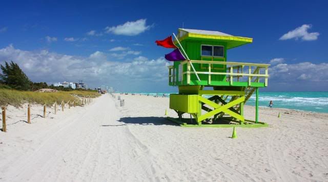
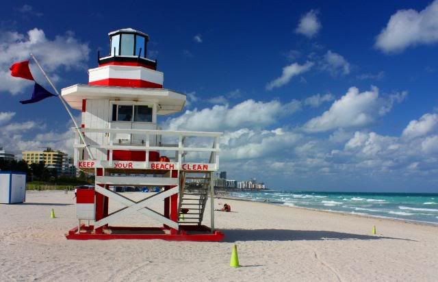 The first of many of Miami Beach's unique lifeguard stands. This one near the jetty at Government Cut.
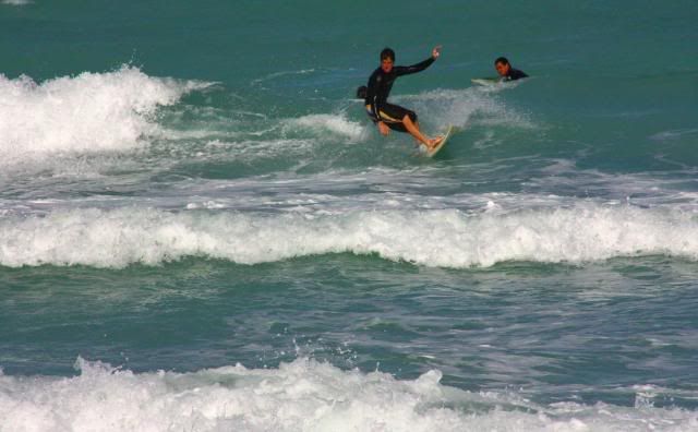 Surfer on the break near the jetty, here off about 2nd Street.
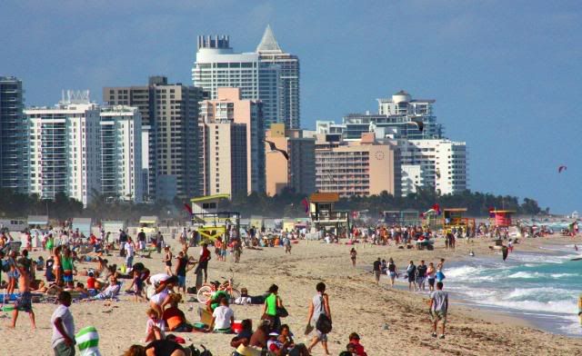 When the surf's up so are the crowds watching.
 Another of the lifeguard stands, each unique.
 I met Debbie at 5th Street and walked up with her to Lummus Park, epicenter of South Beach. (Photo by Debbie.)
 We headed up Ocean Drive (looking north here) to an oasis at about 12th Street.
 At Finnigan's, a pub with Guinness on tap. I had promised myself that I'd get two pints if I walked that detour and arrived on South Beach before the end of Happy Hour, which was 4-7p. I made it at about 5:30, and got the pair for $4 each. (Photo by Debbie.)
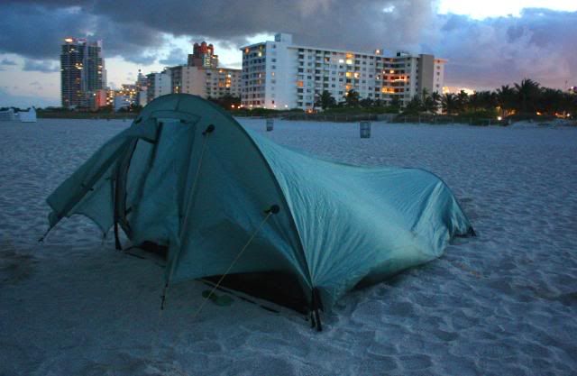 The billowing Henry Shires Cloudburst 2 Tarptent set up at 7th and Ocean Drive, South Beach, home for the night.
Debbie left after watching me set up my tent behind a lifeguard stand. It was blowing like stink, about 20 knots and gusting. After dinner I stretched out inside and a brief, 10-minute shower passed by, the only rain for the entire trek. The tent, even flapping, kept me dry. I was so exhausted that I quickly fell asleep with my industrial-sized can of bear spray and my rigging knife at my side.
I woke up a few times in the night, once to laughter, another to music wafting over from a club on Ocean. I got out of the tent once to reset the titanium stake at the foot that had pulled loose. I dug a much deeper hole and reburied it.
At about 3 a.m., the sound of a pair of ATV's rattled me awake, and the tent was filled with the glare of their spotlights. I got out of my sleeping bag and started to unzip the tent when one of them commanded:
"Alright, whoever's in there come out, but do it so we can see your hands." This was serious.
I came out with my travel pouch still in my shorts and upon request retrieved my drivers license for the cop doing the talking. He looked it over and asked:
"
What are you doing?"
I explained my hike, that I was leaving for Fort Lauderdale in the morning and rambled on until I ran out of things to say. He looked at his partner, then handed me back my license and said:
"Well, make sure you're gone by morning." He turned the handlebars, hit the throttle and they were gone. My night vision slowly returned.
They were extremely professional and I felt not the least bit harassed. I was proud of them, really, especially after the two shootings,
(one fatal,) that had occurred on the sand within a block of my tent
within the past month.
I only woke up one more time, to voices and drunken laughter nearby about 4 a.m., and saw a group of partiers heading back from the water toward Ocean Drive. I snuck over to the bathroom in the park and returned, tightening the lines on the tent one more time. I didn't wake up again until dawn.
In later discussions, I've learned the rule on sleeping on the beach: It's okay as long as it's daylight. (In truth, I knew this already.) So the dozens of homeless people I saw passed out on the beach or in the dunes on South Beach basically slept all day and wandered around all night, in some sort of subtropical
Night of the Living Dead fashion.
Later I talked to one young guy who said they call the people "Land Sharks," and that he had a personal encounter with one a few months before. He had drank too much on Ocean Drive and he and his girlfriend had passed out on the sand. He had the sense to tuck his wallet into his underwear, because he awoke to find razor cuts down the pockets of his pants.
(I didn't tell him that I suspect the "girlfriend.")
Day Two:
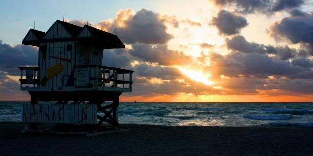
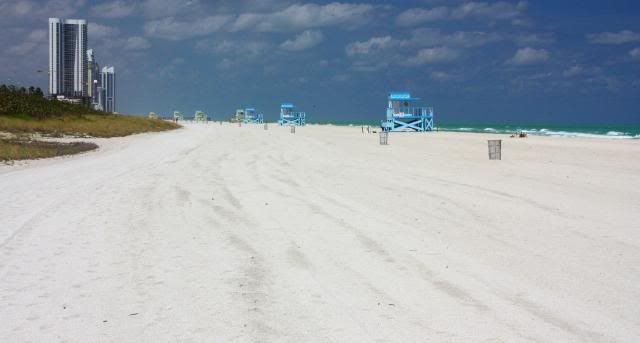
The Seventh Street lifeguard stand at sunrise.
I discovered my nearest neighbor about 30 yards away, a homeless guy near the dunes, through with his night walk.
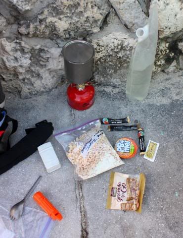
Breakfast out of the wind behind a coral wall in Lummus Park: Goat milk, cereal, bagel with organic peanut butter and honey, and three cups of instant organic coffee heated on the tiny Whisperlite stove.
Repacked, I headed up Ocean Drive to view the Art Deco hotels in the morning light. (ph)
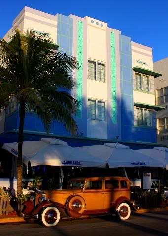
Antique car in front of the Casablanca on Ocean Drive. (ph)
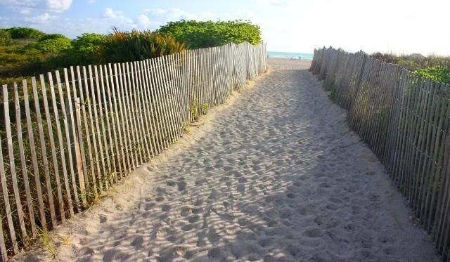
At 14th Street, I walked out over the dunes to resume the beach walk northward.
Landscape of yet another new condo tower with either a fellow UL backpacker, or homeless guy.

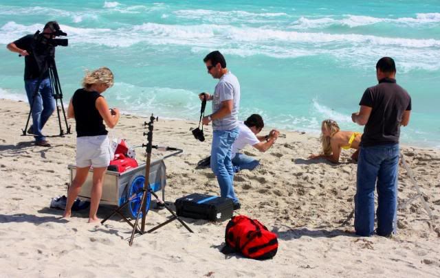
Another model-shoot to break my pace. Despite the four shoots I saw on the hike, business is hurting: Irene Marie Models closes on South Beach.
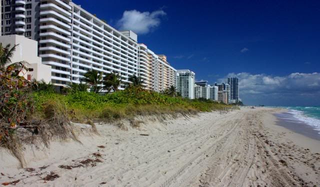
The wall in this beachfront condo canyon above South Beach, most built in a previous boom. Nothing here compared to what I'd see up in Sunny Isles.
This looked enticing, but it was one of the hundreds of private businesses on the public beach, mostly for the guests of the adjacent condo tower. Suppose anyone's kids could play here -- for a price.
I saw many "twin" towers -- with one "just built" and empty, the other one under construction, adding hundreds more condos to The Gold Coast's total. Big question: How many will they actually close on?
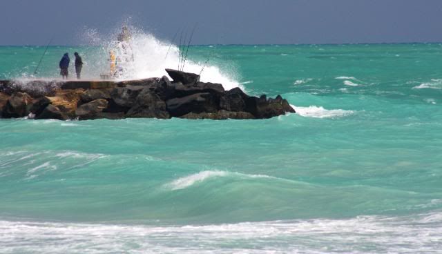
At about 28th Street, I came upon a cluster of rocks just off the beach, with two fishermen surfcasting in the rough waters.
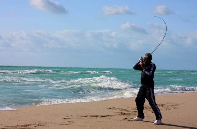
As I approached, I noticed one of them had a good-sized fish "on."
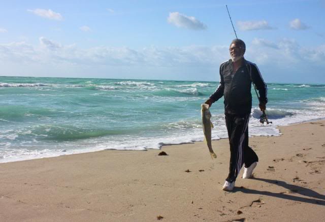
And he reeled himself in a nice snook (it had the black line from gill to tail.) First time, the only time, I've ever seen anyone pull something edible out of the surf in my 20 years of walking or jogging on a Dade County beach.
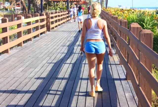
After stopping for a Lara bar, I decided to hike the boardwalk, impressed by the view. But the boards were rough on my feet and and I soon headed back on the sand.
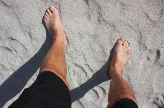
The sand turned deeper and less packed, and I opted to go barefoot for the next 3 miles, clipping my Teva's on a carbiner on my backpack.
I noticed a changing demographic, too. The few beachgoers ignoring the wind were much older than those on South Beach.
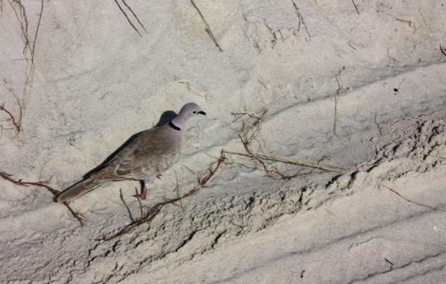
At about 60th Street, I looked over to find I had a hiking companion, a Ringed Turtle-Dove keeping pace long enough for me to whip my camera off my chest and get this shot. Doesn't say much, though, for my hiking speed.
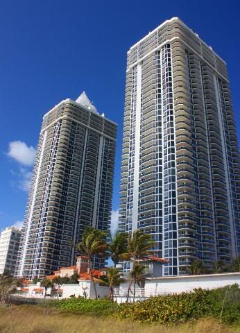
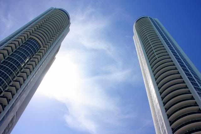
The Blue & Green Diamond condo towers at around 47th Street. Twin 45-story buildings, 630 units, built in 2000,
Feeling momentarily like Peter O'Toole, I gaze at the mirage of Surfside and Bal Harbour rising from the sands to the north.
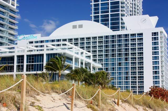
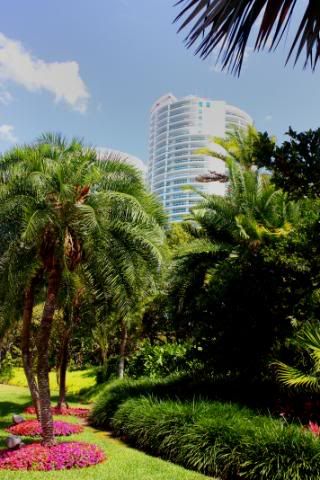
The restored "historic" Carillon (built, 1957,) surrounded by two new condo towers, part of the project run by the "health-conscious & upscale" Canyon Ranch out of Tucson.
Saga of the Carillon (not to be confused with carrion)
Twenty years ago we lived at a marina a mile west of the Carillon, a once faddish, now faded condo building across the street from the supermarket where we did our shopping. The building had been foreclosed, and then one day in 1991 the place was condemned for fire-code violations and the elderly residents were literally thrown out on the street; we could actually see them standing beside their building in their bed clothes, holding a few prized possessions in their hands while we crassly loaded groceries into the car trunk. It was a sad affair, since many were claiming there was behind-the-scenes political manipulation to get the old folks out so the developers could combine it with adjoining properties to make a large development. But the new owners themselves went into foreclosure and the property "flipped" again.
Fast-forward to the New Millenium and yet another foreclosure (was this place ahead of its time or what?) and eventually WSG Development of Miami Beach got it and they hired on Canyon Ranch to give it a name and a new identity. Canyon Ranch labels itself as the “world’s premier health resort,” with a mission of 'inspiring (people) to make a commitment to healthy living.'" That may sound like one resort but there's really a bunch of them, so they must be like the Starbucks of "the world's premier health resort(s)."
But the hotel/resort in the gutted and redone Carillon occuppies only 150 of the suites, and all the rest of the units are what's really going on over there; they're condos.
This has happened up and down the coast, from Coconut Grove to Jupiter, where they announce an exclusive 5-star, five-story resort/hotel is coming to our neighborhood and we, the neighbors feel really chic and cool to the point that we tend to gloss over, even ignore the part where they say, "and there will be fifty floors of condos tacked on above it." We ignore the problems of the density, the need for new infrastructure, the loss of the view, the shere mass of concrete looming overhead.
I'm giving serious thought to approaching Canyon Ranch and see if I can get a concession there at the Carillon. Not massage, and not as a personal trainer. I want to conduct one of those tacky, unoriginal haunted tours that you see in every seedy tourist trap in America. Because this place is bound to have some pretty pXssed-off ghosts.
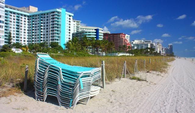
Landscape with stack of turqoise lounges and condos.
The wall of condos at Surfside.
I swear I heard the art director shout, "Crawl!" And I almost fell on all fours.
A respite from the condo canyon: Ocean Rescue stand on a wide beach around North Shore State Recreation Area (80th St.)
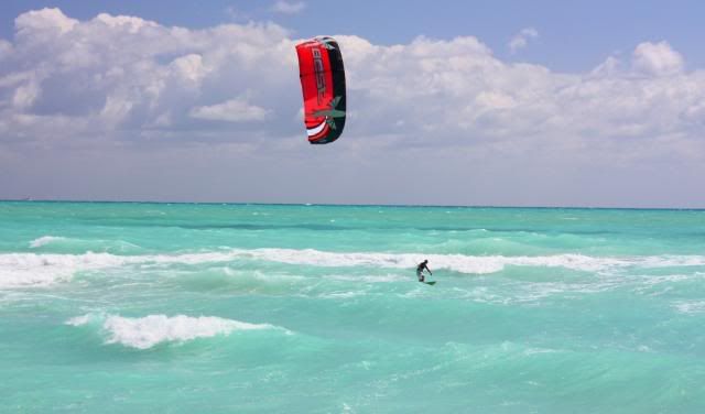
The hike is complemented with an occassional kiteboarder.
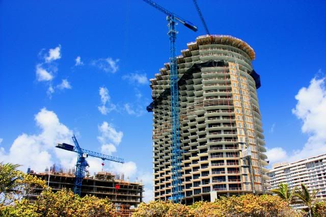
And the construction rages on, here in Bal Harbour.
Old pier in the surf off Bal Harbour, with Sunny Isles shimmering on the horizon.
Looking from the Bal Harbour jogging path over the berm to the beach. A nice touch. I got on the boardwalk to try to find a way through the impenetrable buidlings of Bal Harbour, since I had to cross the A1A bridge over the inlet to continue north. The only access I found was alongside the inlet. The Surfrider Foundation and environmentalists have been battling Bal Harbour recently over the continued strangling of public access to public beaches.
Fishermen get dowsed by waves on the Haulover Inlet jetty.
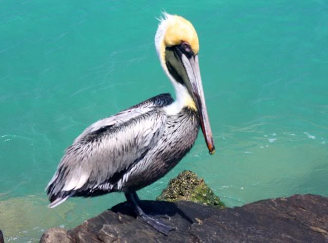
Brown Pelican, hanging out at the inlet before flying off to dive-bomb for dinner.
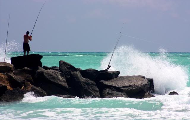
Brave, lone fisherman at the end of the jetty.
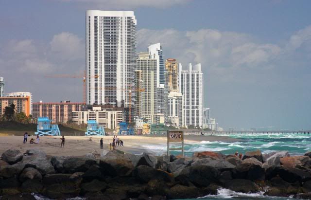
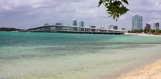
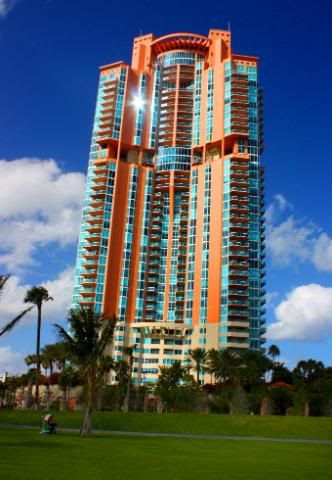
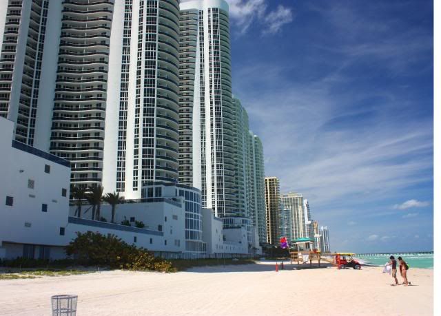
Across Haulover Inlet, rising Oz-like in the sand, is the post-Millenium condo-creation known as Sunny Isles. The similarities between Sunny Isles and Dubai are apparent.
Over the fixed bridge at Haulover Inlet, in the midst of what sailors call "a rage." That's when strong onshore winds meet a strong outgoing tide. The waves where they meet aren't fun. I saw a single sportfisherman wisely turn back to the dock.
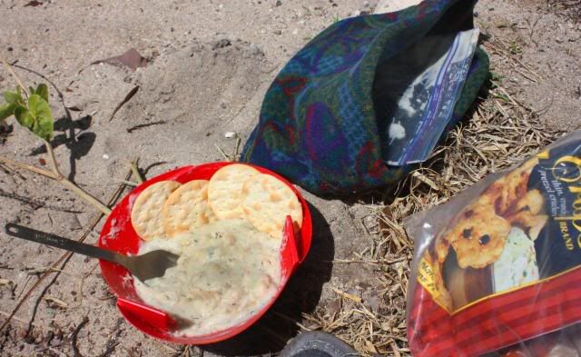
Lunch at Haulover: Clam chowder in an ultralight origami bowl (with real clams.) Simple recipe: Boil two cups of water and pour into the freezer bag with the dehydrated ingredients and clams, stir and put in the cozy (the fleece beanie with the bag) for 5 minutes. Served with crackers, followed with freeze-dried fruit and raisins for dessert. I found the only calm spot to cook near Haulover's entrance kiosk, and spent much of my lunch talking to an older man who drove up in a mid-'80s Cadillac and said he was a rabbi. We had a nice talk, although he couldn't fathom what I was up to.
I resumed my hike up Haulover Park on the wide and empty beach. I wondered where all those nude people were that I'd heard about for years, since I saw no one.
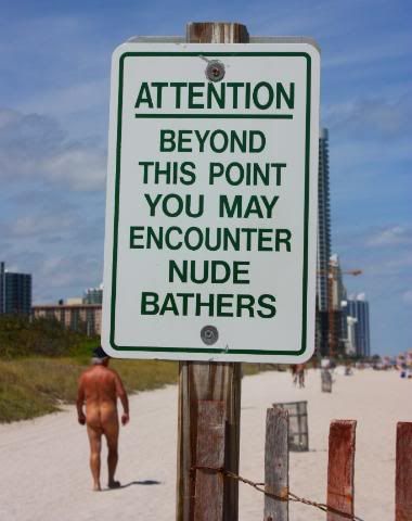
Then off in the distance I saw a crowd, and approaching, found a quarter-mile stretch filled with sunbathers, most nude, fenced in with a warning sign for the unsuspecting.
That didn't startle me; I was next to Black's Beach when I lived in Del Mar, CA back in my twenties. What I wasn't prepared for was the shock at seeing the condos so close to the beach and the water once I had entered Sunny Isles. Note the required wall here because there's no setback. How unappealing is that?
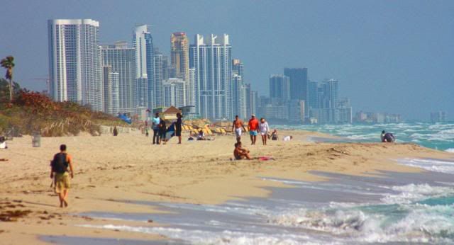
The stretch through Sunny Isles was long, hot and mostly ugly. Through rampant overdeveloment and what appears to be no regulation, they've built monstrous towers down the beach, blocking out the rays from that orb they named the town after and that brought many of them there in the first place.
A Miami Sunpost columnist, Rebecca Wakefield, gave the best description of Sunny Isles transformation in the paper a year ago:
"Sunny Isles Beach is a travesty of overdevelopment. These four men, (Donald Trump, Michael & Gil Dezer and) Jorge Perez in particular, are responsible for turning a sleepy and dilapidated but charming beach town into a glittering canyon of inaccessible glass and steel."
Crowding condos against the beach is the same thing as ripping out a vineyard in the Napa Valley to replace it with houses on streets named Chardonnay and Zinfandel. Only they don't let you do that in Napa. They have laws against it. Because once you put in a subdivision, you'll never have a vineyard again. Same here, only there's no laws and the battle is being lost.
During that hot & sunny stretch through Sunny Isles, I planned my stops in the dunes hidden by the shade of the tallest condo towers. I'd find one off in the distance and make that my goal. Once there, I'd shed my pack in the berm and take a 10-minute rest. And that's when it hit me.
People supposedly were buying condos in these gargantuan towers without any setback so they could play in the sun and the surf. Yet because of those condos, after about one in the afternoon, those residents were deprived of the sun because their building's shadow obliterated it. That's absurd.
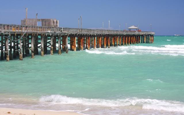
The historic Sunny Isles pier. Surprised they haven't built a 50-story condo tower out on the end.
This image tells alot: The crowd of mostly French Canadians in their beach chairs are not from the condo highrises. They were going to and fro from the remaining '50s and '60s two-story hotels still standing untouched between them. Those quaint hotels haven't been decimated -- yet -- to make it a solid wall of empty 50-story towers.
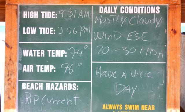
Weather conditions for March 25th, 2009 at a Sunny Isles ocean rescue stand.
Twin towers blocking the sun in of all places, Sunny Isles.
A Revelation
So maybe this was the lesson learned on the hike: That we've got to stay vigilant. And without regulation, we're at the mercy of people who would pave our paradise -- even theirs -- if it would put one more dollar in their pocket.
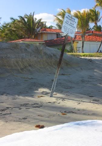
Into Golden Beach, a stretch of private beachfront residences, where signs on the sand repeatedly told me I was probably trespassing. The sign actually says that private property extends 50 feet toward the ocean from the sign "as surveyed." Florida law says beaches are public and accessible to all citizens up to the mean high water line. So what's up with this? The water is within 10 feet of this sign, and it isn't even high tide!
Didn't those fools that built in Galveston lose their land when Mother Nature in the name of Ike washed it all away?
Seems like the owners who think they can privatize Florida's public beaches should foot the bill for a multi-million-dollar beach restoration, or else they need to put another shrimp-kabob for me on their backyard (beachfront) barbie!
Ticking off the beach towns.
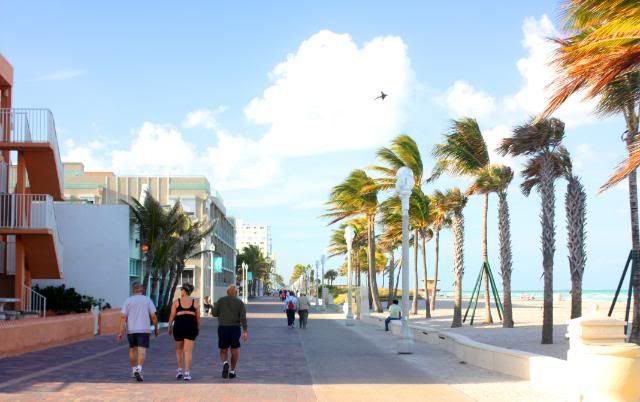
I veered off the wide beach in Hollywood and did several miles on its quaint, extremely people-friendly boardwalk. So different from the sterile condo towers to the south. Hollywood, with its wide beach, boardwalk, quaint pubs and shops and lack of condo towers was such a good way to begin the closure of this hike. Hollywood reminded me more of Santa Monica or Ocean Beach in San Diego than Sunny Isles. The civic people here should be lauded. How did you ever hold out? How did you not fall prey to the developers? When the economy 'recovers,' will you be next?
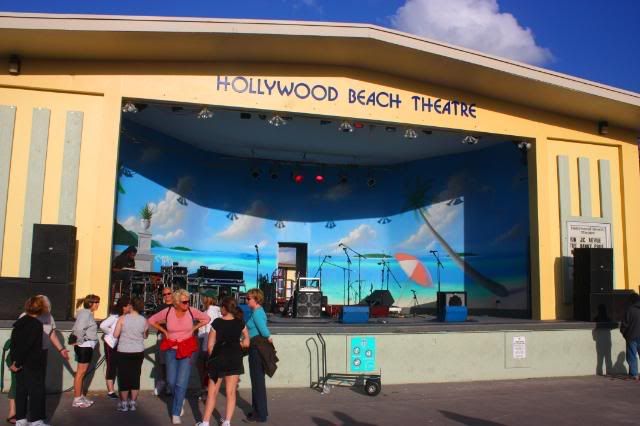
Locals and tourists gather for the nightly seasonal entertainment on stage at the Hollywood boardwalk. I, unfortunately, had to press on.
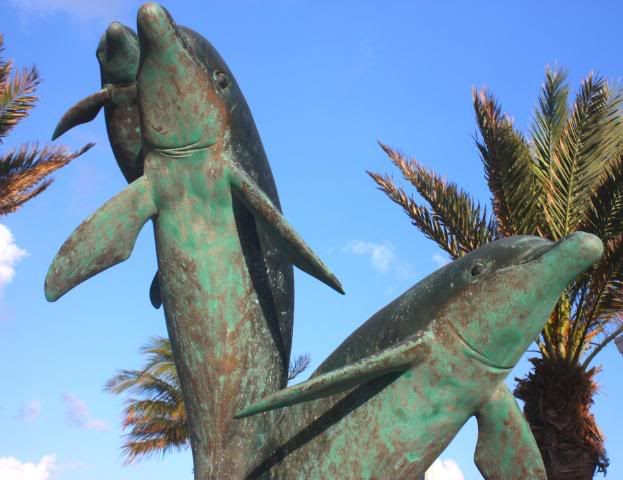
Dolphin statue, accessible to the public, off the boardwalk in north Hollywood.
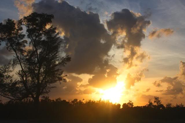
Trudging those last steps past the Dania Beach Pier, looking left at the sunset as I approach the fence marking the border into John U. Lloyd State Park.
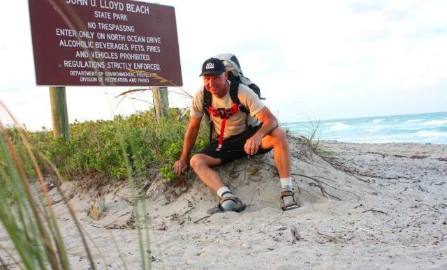
Self-portrait with timer beside the sign at John U. Lloyd, hike over at mile 37.5.
E N D
addendum:
Many people ask me what's in the pack.
Base weight (pack, tent, sleeping bag and sleeping pad):
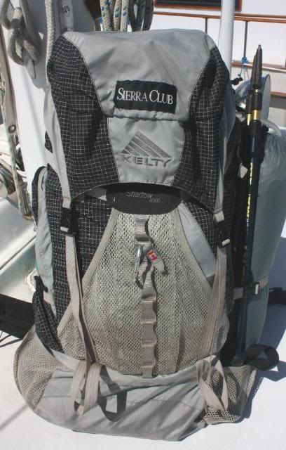
Kelty Shadow backpack -- 62 oz. (1 lb. equals 16 oz.)
Outbound 40-degree sleeping bag -- 42 oz.
Tarptent Cloudburst 2 -- 39 oz.
pad -- since on sand, none
I had about 3/4 of a gallon of water on my back. A two-liter platypus type bladder with drinking hose (to sip on while still walking), and a cheap quart bottle in a side pocket. So that water weighed about 6 pounds.
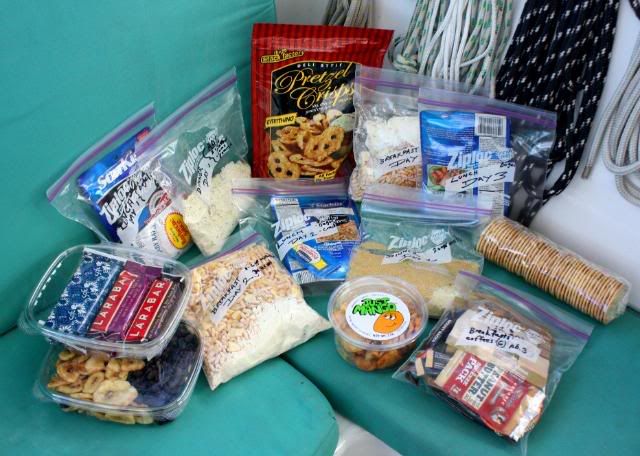
The food, enough here for 3 days, although I ended up doing the hike in two, was put in freezer bags and labelled, with snacks and crushable items put in recycled Whole Foods sandwich boxes:
There is still a lot I can do to go lighter.
Advertisement
Tot: 0.098s; Tpl: 0.017s; cc: 9; qc: 45; dbt: 0.0488s; 1; m:domysql w:travelblog (10.17.0.13); sld: 1;
; mem: 1.2mb


Carlos Miller
non-member comment
Nice write-up!