Lebanese Transportation, Lebanon Transportation
Advertisement
Railways: Total: 401 km standard gauge: 319 km 1.435-m narrow gauge: 82 km 1.050-m note: rail system became unusable because of damage during the civil war in the 1980s; short sections are operable (2004)
Highways: Total: 7,300 km paved: 6,198 km unpaved: 1,102 km (1999 est.)
Waterways:
Pipelines: Oil 209 km (2004)
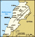
Ports and harbors: Beirut, Chekka, Jounie, Tripoli
Merchant marine: Total: 44 ships (1,000 GRT or over) 198,602 GRT/248,313 DWT by type: bulk carrier 4, cargo 26, livestock carrier 8, refrigerated cargo 1, roll on/roll off 2, vehicle carrier 3 foreign-owned: 6 (Austria 1, Greece 5) registered in other countries: 40 (2005)
Airports: 8 (2004 est.)
Airports - with paved runways: Total: 5 over 3,047 m: 1 2,438 to 3,047 m: 2 1,524 to 2,437 m: 1 under 914 m: 1 (2004 est.)
Airports - with unpaved runways: Total: 3 914 to 1,523 m: 2 under 914 m: 1 (2004 est.)
Heliports:
Advertisement
The information here has been derived from Public Domain Sources such as the CIA World Factbook. No liability can be taken for any inaccuracies.
Tot: 0.045s; Tpl: 0.007s; cc: 3; qc: 10; dbt: 0.0129s; 1; m:domysql w:travelblog (10.17.0.13); sld: 1;
; mem: 1.1mb
 Lebanon has made progress toward rebuilding its political institutions since 1991 and the end of the devastating 15-year civil war. Under the Ta'if Accord - the blueprint for national reconciliation - the Lebanese have established a more equitable po...