Advertisement
Published: October 2nd 2011
In the second century AD, the Romans had conquered the southern half of the island of Great Britain. Having decided it wasn't worth his while to attempt to go north of the Tyne river, Emperor Hadrian instead maintained a border to keep the Roman lands to the south separated from the northern tribes. But he was soon to discover that those crazy barbarians today known as "Scots" caused a lot more trouble than a simple border control could handle.

So he built a wall.
Hadrian's wall (aptly named "Hadrian's Wall") was constructed between 122 and 130 AD. It is 73 miles long running east-west from coast (near Newcastle) to coast (near Carlisle), is estimated to have been 13-15 feet high, was manned by Roman soldiers at every mile (at posts aptly named "milecastles"), and - like every other wall you see around farm and pastureland today - is made of stone.
Funny enough, Hadrian's Wall does not follow the present-day border between England and Scotland. After centuries of struggle (probably to be documented in a later entry after I visit the border town of Berwick upon Tweed), the actual England-Scotland border was settled considerably north of the wall.
On its eastern side, bits of the wall remain in Newcastle today, running through city centre and terminating in the neighborhood aptly named "Wallsend." The largest part of the wall still intact runs along the southern portion of Northumberland National Park.
Which is where I went this weekend.
There is a bus running between Newcastle and Carlisle that traces the wall and the 73 mile footpath, making stops at several towns, villages and historical sites along the way. It's called the AD 122. (See what they did there?)
I took the bus about halfway to Carlisle, intending to follow a path outlined in a book called, "The Best Walks in Northumberland". On the 90 minute bus trip, we went through towns called "Walbottle" and "Heddon on the Wall." (I swear I am not making these up...Google them if you don't believe me.) Fans of Neil Gaiman's "Stardust" will be excited to hear that there is even a village called "Wall." Whether the town's name refers to Hadrian's Wall or a hidden barrier between our dimension and a magical one remains to be seen.
Outside of national parks, rural Britain is strikingly similar to central New York, by which I mean
this and not
this. In the NNP, the rolling hills get a bit more dramatic, but livestock farming pretty much dominates.

My favorite thing about small-town England (besides the names) is the tiny villages. Their streets are impossibly narrow and winding; every time the bus turns a corner you wonder how it isn't hitting multiple houses
at the same time. Cottages with picket fences and flower gardens, inns, pubs, schools, churches: all the same color stone and compressed in a little block in the middle of open countryside. I imagine growing up in that kind of environment would have multiple disadvantages, but we have nothing like it in the US, which makes it fun to see.
I took the bus to the Northumberland National Park centre in a tiny not-even-a-village place called "Once Brewed". The 7 mile route I took follows a public footpath running through farmland on the northern side of the wall, then joins with the Hadrian's Wall footpath east of a Roman fort called "Housesteads". The route then doubles back, tracing the wall back to the starting point at Once Brewed.
I never understand what you mean when you do this. Visual please. Note that although the people who created this map use the Pennine Way to get to the wall, I continued along the trail (the dotted green line) and then came back.
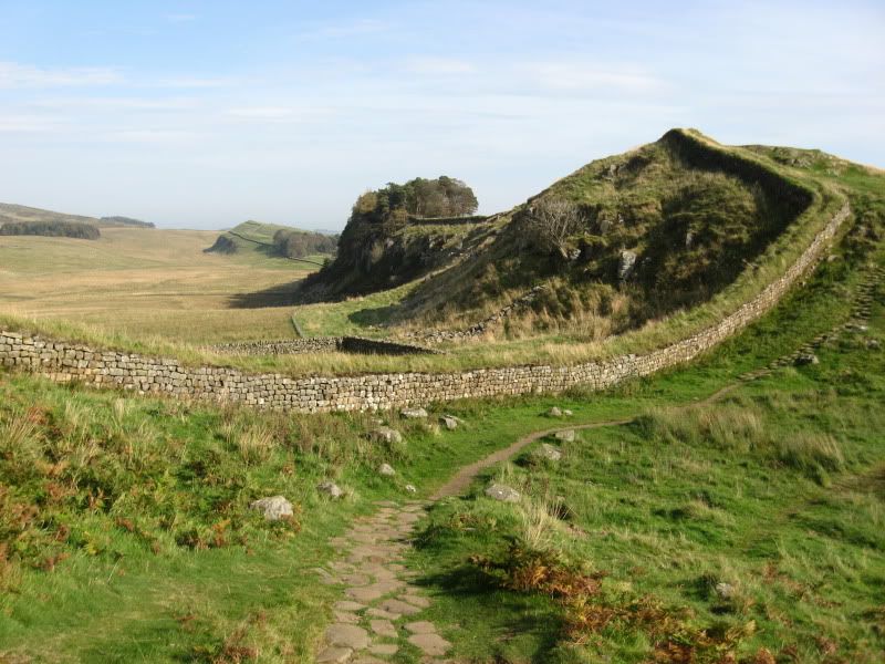
Although well-marked as a public footpath, the northern portion of the route was devoid of people (though I did spot a few of them later in the afternoon from my vantage point on the wall), which was a shame because the views of the wall from the north were - as my guidebook had predicted - "spectacular".
It may be difficult to see, but Hadrian's wall runs along the top of the ridge (called "Whin Sill") and down through "Sycamore Gap".
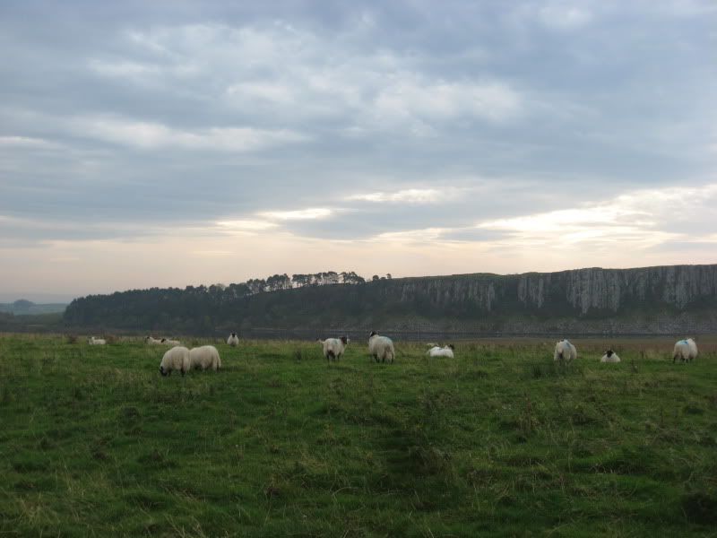
No people, but quite a few herds of cows and sheep.
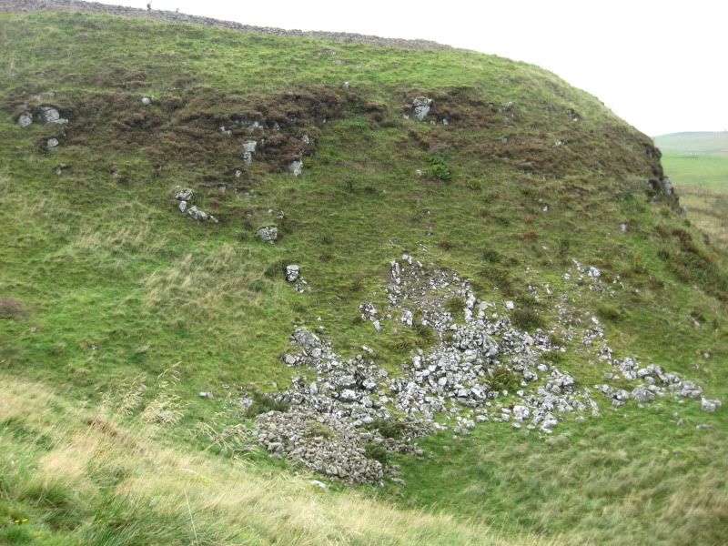
That is a regular farm stone wall, not the one that Hadrian's men built. It's amusing (to me at least) how similar the two can be.
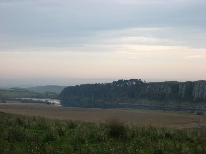
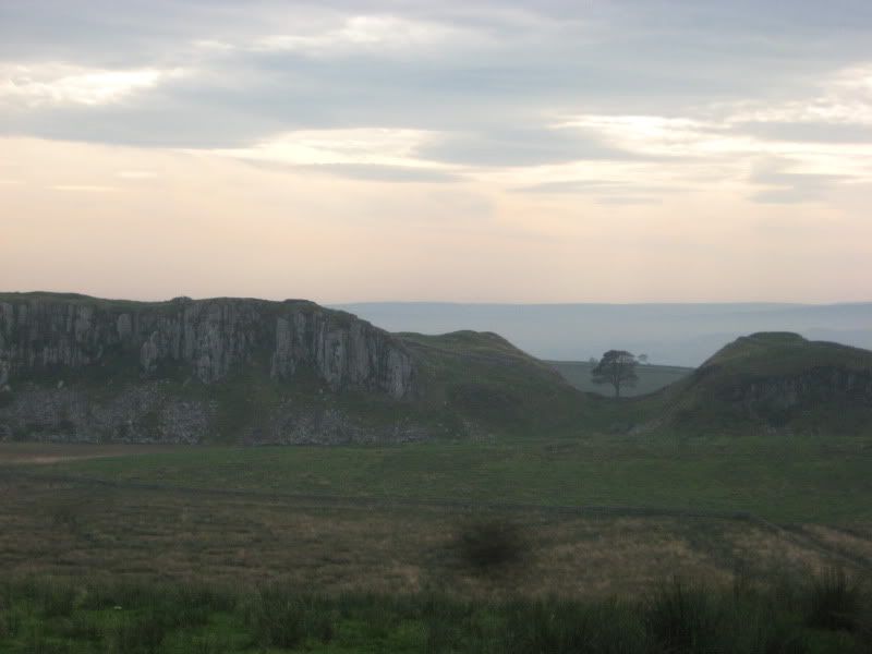
Another view of Whin Sill, with Craig Lough beneath it. Coming back along the ridge, I came across a guy rock climbing down the cliff face by himself. He had all the gear and everything, but still... My parents can take comfort in the fact that despite all the stupid things I do (or attempt to do) on my own, THAT will never make the list.
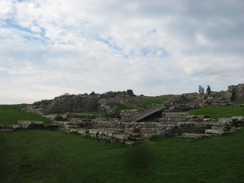
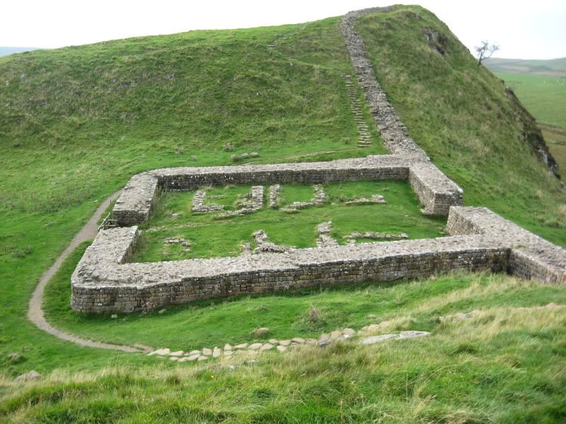
Shortly after the footpath joined the Hadrian's Wall path (where I turned around and climbed the ridges I had been oogling all morning), I came to the remains of a Roman fort known as Housesteads. That is not its Roman name (Vercovicium) and I have no idea why they call it that now.
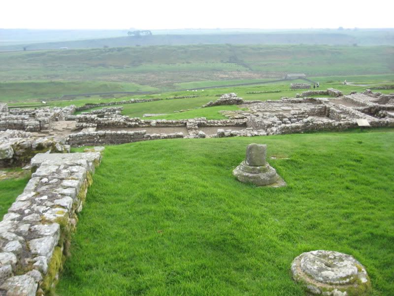
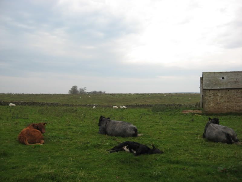
As expected, it was home to a military garrison that kept an eye on movement across the border, but it also housed a few civilian families. Other than "living off the land", I'm not sure what they did, but I wonder if parts of the area (namely the parts covered in sheep) look similar to the way they looked 2000+ years ago.
West of Housesteads (through the forested area on top of the ridge in the above pictures), hikers were allowed to walk on top of the wall for a stretch, though a short one. A lot of effort has been made to keep the wall and surrounding area as intact as possible given the amount of people who go traipsing through there every year.
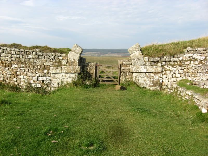
The first milecastle after Housesteads. That bit to the left of the door is the highest section of the wall still standing.
A few sharp climbs and dramatic descents later, the second milecastle. "Mile" here refers to the Roman mile, which is apparently less than ours - Hadrian's Wall is 80 Roman miles long.
Much as I was looking forward to passing through Sycamore Gap - big, pagan-like tree between dramatically high ridges, seems very pre-medieval British - I admit that by the time I got there, I was so tired that I wasn't thinking, "ooh pretty tree, let's take a picture!" as much as, "ANOTHER hill? What were these people thinking?"
(I understand that by stationing the wall and troops on top of Whin Sill, the Romans were giving themselves the high ground in any potential confrontation with the northern tribes. But I get it mainly because I am now sitting comfortably at my desk.)
Although not as much as in other places (Cader Idris, Holyrood Park in Edinburgh), parts of the path reminded me a bit of the Alaskan tundra.
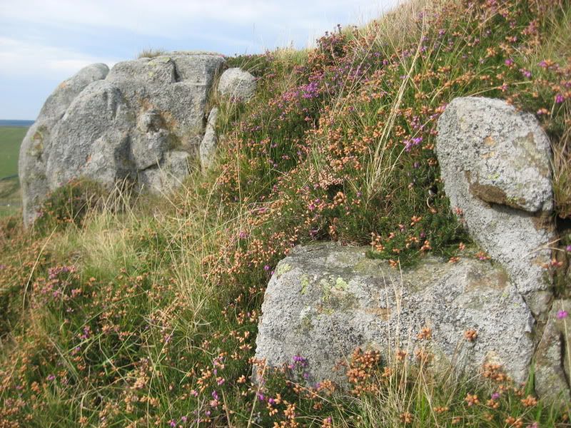
Complete with low, dry brush and lots of rocks that are REALLY helpful on the steep inclines.
All in all a wonderful way to spend my last weekend before class, and I'm seriously grateful to British weather for holding out one more day. Next week if time and weather allow it, I may try for a trip to Tynemouth, the aptly-named coastal town complete with open market and remains of a priory by the North Sea. Also, in case you haven't guessed, the mouth of the Tyne river. That never gets old...
Advertisement
Tot: 0.141s; Tpl: 0.011s; cc: 10; qc: 53; dbt: 0.0757s; 1; m:domysql w:travelblog (10.17.0.13); sld: 1;
; mem: 1.1mb


Kristen
non-member comment
How cool that you have time to explore before classes start! Great pictures!!