Advertisement
Published: June 28th 2008
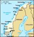
I've arrived safe, but road-weary in Trondheim. I'm going to have a rest day here tomorrow (so I can watch the football final!!!) and then we'll see. I'm thinking about taking a train just a bit to catch up on a couple of lost days. In that way I can enjoy the end more rather than having to race to get there. I should say I have now got a flight booked back home,, from Stockholm to Edinburgh! May sound crazy - but there is method to my madness... you'll see in a bit!
Anyway I'm about to get kicked out of the library so I'll have to do the text to this later. Seen some amazing scenery, at least 4 huge passes, and a 100 mile day!!!
Ok the details:
So I set off from Voss with a hint of sunshine in the air with my new fluorescent yellow pannier bag and up the road following the main rail line to Oslo. The road is a dead end, but from the station there called Upsete you can catch a train for 5 minutes through a tunnel to Myrdal station and carry on. Actually this is is part
of a famous cycle route (formerly the navvies road) very popular in late summer, which passes next to the Hardinger glacier. I heard from another cyclist (german Christoph) who I just met in my dorm here in Trondheim that he tried the whole route but it was unpassable due to the snow. Anyway I cycled up the road with a slight time pressure (train at 2.30pm) and was getting a little alarmed at one point before fianlly hitting the dirt track up to the last stop Upsete at 900m. I made it with 20 minutes to spare and huddled in the waiting room looking out at the stark snowy landscape. As the train approached I jumped out and flagged it down - yup the stop is an optional stop, so it's more like catch a bus than a train.
Through the other side to Myrdal, what a change - it's more like Disneyland that station as it's the top of the Flamsbana railway. There were packs of tourists, mainly Japanese. I can just imagine them salivating many months ago as they booked there tickets for the journey back in Tokyo. Fortunately there's a path down to Flam so I
didn't need to take the train. What nobody had told me was that the first 300m is a vertical rock-strewn switchback. There's an amazing waterfall there at the top, which gouges a channel in the rock before plummetting off the edge. I inched cautiously down the track with brakes on full bouncing over the rocks with my less than suitable bike (an mtb with disk brakes would be great for this), overtaking a group of walkers, before being reovertaken by them. After that though it opened out to a proper road and a very nice 20km down into Flam with more waterfalls than you could shake a stick at.
By the time I reached Flam the rain had started to come down and it was turning into a very bleak day. That was my first view of the Sognefjord, the longest fjord in the world, but it was a bit of anti-climax I guess. I headed up the fjord to Aurland and then was hit with a dilemma. It was too late for a ferry from there (which in any case went back the way I'd come towards Voss) and onwards the road was blocked by a long tunnel.
The old road was a pass straight up to 1340m and straight down the other side. Well with the rain, and a rather alarming reemergence of my knee pain (this time the right knee - could it be related to the accident of the previous day)I opted for catching a bus through the tunnel. It turned out that the tunnel is the world's longest road tunnel at 25km long. After the first 5km I drifted off to sleep in the warmth of the bus (expensive by the way!). The bus plonked me off at the other end and I cycled to Lærdal only to discover another car only tunnel blocking my route. From Lærdal there is a ferry to where I wanted to go, but the last one had already left, so I had little else to do but make camp a little way out of town just overlooking the fjord and make an early start for the 8.30am morning ferry.
That next day the weather was much kinder. I hopped on to the ferry and was in Kaupanger (old style wooden church there - but you have to pay to go in!) then Sogndal (the regional capital) before
long. I bought some new brake blocks there - the last few days had wiped my rear brakes to the metal, incredible! And just popped into the library for 10 mins of free internet when I bumped into Jordi, a Spanish guy I'd met in Bergen. It's a small world. We had a bit of a chat (i didn't have to leave for a while as I had another ferry 10km down the road in an hour and a half) which was nice and he advised me all the amazing places he'd just seen (by hire car) where i was heading. I thought I'd left in plenty of time, but it turned out there was a bit of a climb over to the next ferry, and coupled with a very misleading cycle sign (to avoid a tunnel) it was 12.55pm and I was 3km away from the 1pm ferry. I raced down those final kms with mathematical calculations of my required average speed in my head. It was going to be close. It was... I missed the ferry by 10 seconds.
But amazingly as I cursed there on the dock the ferry came back for me! So a big
thank you to the Urnes ferry driver!
Here the fjord was very magical looking even though the sun wasn't quite shining. Across the river was another oldstyle wooden church where I had a spot of lunch and some very nice norwegian strawberries. Heading on I'd been warned that there were some unlit tunnels on the road (it was a minor road with almost no traffic). I hadn't been warned of the killer seagulls which attacked me over a 300m stretch. Okay they didn't actually strike me, but they swooped down about 10 times about a foot over my head. Very unnerving!
The longest tunnel was over a km long. Cycling inside that was extremely surreal. You can see almost nothing even with the lights on. You certainly can't see the road, just faintly the whitewashed tunnel walls (which you know you can't approach too close as the tarmac doesn't reach them). I was glad that no other cars came through when I was in there as the noise can be deafening.
Out the other side I headed to the base of the Jotunheimen pass - the highest road pass in northern europe...
Stats
-------
Day 29- Voss to Lærdal - 22/6
Dist (miles): 50.54
Ave speed (mph): 9.9
Max speed (mph): 31.5
Time on saddle: 5h04
Day 30- Lærdal to Turtagrø - 23/6
Dist (miles): 50.30
Ave speed (mph): 9.6
Max speed (mph): 33.5
Time on saddle: 5h14
Advertisement
Tot: 0.088s; Tpl: 0.013s; cc: 10; qc: 25; dbt: 0.0626s; 1; m:domysql w:travelblog (10.17.0.13); sld: 1;
; mem: 1.1mb