Advertisement
Published: February 25th 2013
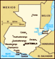
We are just back from a four day road trip to the Eastern part of Guatemala and then on North to the great ruins at Tikal, deep in the jungle of the Peten. There is a map of it as Photo 1.
Almost all the way to Rio Dulce, the road runs along the edge of the great Motagua fault, with the Rio Motagua running along in the trough. This fault is rich in minerals, and somewhere along it is where the ancient Maya mined their jade. It comes in sizes from pebbles to boulders, but the boulders are hard to recognize because they are covered by a limestone crust. To find it, you just bang on them until you find one where the crust breaks off to reveal a beautiful green-veined rock so dense and hard that it deforms your hammer.
We treated ourselves to a private van and driver, partly because of the horrible traffic in Guatemala City, which we had to pass through twice, and partly because there have been banditos after you get into the Peten, and I didn't want to get lost there. There was an unusual traffic jam just as we got into
 2.Stele 3 in its hut
This is the tallest Mayan stelethe heavy stuff approaching Guatemala City. Flashing lights, an ambulance, a sizable crowd of gawkers, and a dead body, face covered by a sheet on the side of the road. Some poor campesino had underestimated the ferocity of the city traffic, trying to make it across eight lanes of freeway. I was really glad not to be driving.
Our driver was Paulino, 47 years old. He understood English a little, but spoke nearly only Spanish. This was good for Carol, who hears lots of Spanish on the TV but does not get much practice speaking. Also for me. We communicated well enough. On the way out of the City, we passed a truck loaded with soldiers of the Guatemala Army. I asked Paulino if he was afraid on the Army. No, he said, he had many friends in the Army and he trusted them to keep us safe from "bad people". He said he had a friend in the Army who had just been sent to the Congo, as an advisor on communications, "muy peligroso, El Congo". I was just a tad surprised, as I did not know that Guatemala had sent forces to the Congo. But I Googled
3.Face on Stele 3
Nice face and clear glyphs it, and
it is true . Click the blue link; it is to Al Jazeera.
Paulino offered us a stop that he knew about, just 4 km off the highway; a Maya center named Quirigua. It was small but interesting. There is no temple, just a big open space ringed by steles, with a ball court, probably used as a local market or festival site. The steles are the tallest ever. See photos 2 and 3. Photo 4 shows how thick the jungle is just at the edge of the Quirigua site.
The 4 km road into Quirigua passes therough an old United Fruit plantation. I have never seen such dense monoculture, but it is typical of banana plantations, I am told. Every growing bunch of bananas is protected by a blue plastic bag, perhaps as protection against a virulent new
banana disease that is sweeping the world, exactly as Darwin would predict for any too-intensive monoculture. See Photo 5.
On the way out, we had to stop because of bananas crossing the road. They were on a long conveyor chain, and we were stuck more than 20 minutes. Some motorcycles dodged through between the fast moving stalks of bananas,
4. At the edge Quirigua
This is the forest primeval... but cars and buses had to wait. Finally they swung the conveyor chain out of the way, and we were off for Rio Dulce.
Next morning at 8 AM sharp we boarded a launch named La Amarosa for a tour of the Rio Dulce. As we zoomed at high speed, it began to rain and the pitiful awning over the launch offered no protection at all. The rain was hitting us in the face at about 20 knots. We had a black plastic sheet that gave some protection for the camera and clothing, but I remember thinking to myself "This is the most unpleasant experience of my entire life- and I am paying for it." Then far ahead a small patch of blue appeared, and after an interminable time we were in the sun again.
The bird life on the Rio Dulce is amazing, and it changes as you go from the sweet water to the estuary to the salt water of the Carribbean Sea. At first there are herons and cormorants, all living on the abundant fish of the Rio Dulce, changing as you go to gulls and pelicans, who prefer the salt water. The people are
5.Banana monoculture
Only the banana tree is allowed here. interesting too- they live a seemingly idyllic life in small huts out on the water, living by catching and selling fish too the landlubbers. At the end of the Rio is the isolated little town of Livingston, reachable only by boat, where a unique African-Carribbean culture exists, unlike anything anywhere else. At our hotel that evening, we saw a troop from Livingston dancing to African drum music. They looked like they were staight out of Africa. Look at Photos 7 through 12, which I present without further comment. This blog is too wordy already.
Advertisement
Tot: 0.144s; Tpl: 0.018s; cc: 11; qc: 50; dbt: 0.0698s; 1; m:domysql w:travelblog (10.17.0.13); sld: 1;
; mem: 1.2mb


Lynn Susan Beebe
non-member comment
Reliving our trip!
We loved Quirigua and Rio Dulce...spent a week on Lago Izabal before leaving Guatemala. If you go back through, see if you can get to the hot waterfall west of town at Finca Paraiso ...amazing! We are in the midst of a big storm and lost power for a while...back on now, at least for the time being...