Maldivian Geography, Maldives Geography
Advertisement
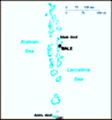
Location: Southern Asia, group of atolls in the Indian Ocean, south-southwest of India
Geographic coordinates: 3 15 N, 73 00 E
Map references: Asia
Area: Total: 300 sq km land: 300 sq km water: 0 sq km
Area - comparative: About 1.7 times the size of Washington, DC
Land boundaries: 0 km
Coastline: 644 km
Maritime claims: Measured from claimed archipelagic straight baselines territorial sea: 12 nm contiguous zone: 24 nm exclusive economic zone: 200 nm
Climate: Tropical; hot, humid; dry, northeast monsoon (November to March); rainy, southwest monsoon (June to August)
Terrain: Flat, with white sandy beaches
Elevation extremes: Lowest point: Indian Ocean 0 m highest point: unnamed location on Wilingili island in the Addu Atoll 2.4 m
Natural resources: Fish
Land use: Arable land: 13.33% permanent crops: 16.67% other: 70% (2001)
Irrigated land: NA sq km
Natural hazards: Low level of islands makes them very sensitive to sea level rise
Environment - current issues: Depletion of freshwater aquifers threatens water supplies; global warming and sea level rise; coral reef bleaching
Environment - international agreements: Party to: Biodiversity, Climate Change, Climate Change-Kyoto Protocol, Hazardous Wastes, Law of the Sea, Ozone Layer Protection signed, but not ratified: none of the selected agreements
Geography - note: 1,190 coral islands grouped into 26 atolls (200 inhabited islands, plus 80 islands with tourist resorts); archipelago with strategic location astride and along major sea lanes in Indian Ocean
Advertisement
The information here has been derived from Public Domain Sources such as the CIA World Factbook. No liability can be taken for any inaccuracies.
Tot: 0.047s; Tpl: 0.007s; cc: 5; qc: 8; dbt: 0.008s; 1; m:domysql w:travelblog (10.17.0.13); sld: 1;
; mem: 1.1mb
 The Maldives was long a sultanate, first under Dutch and then under British protection. It became a republic in 1968, three years after independence. Since 1978, President Maumoon Abdul GAYOOM - currently in his sixth term in office - has dominated t...