Advertisement
Published: March 19th 2007

 Sunset at Waras Hut, Km 6 on the trail up Mount Kinabalu
Waras Hut was my accommodation for the night on the trail up Mount Kinabalu, before attempting the summit. I reached Low's Peak at 5.45am the next morning. The highlights of a trip to Sabah include the diving at Pulau Sipadan, the Orang-Utangs at Sepiloc and climbing Mount Kinabalu. Mount Kinabalu is the highest mountain between the Himalayas and Papua Burat (New Guinea Island). It's a very steep climb from 1,800m to 4,100m through 3 different ecological zones. The park surrounding this massive granite rock is a world heritage site with one of the greatest ecological diversities on earth.
You can tell the tourists who have just climbed the mountain. They're the ones that limp; that can't, or at least don't want to walk up steps. I was one of Mount Kinabalu's victims. It's not the climb up the mountain that's the problem. It's the walk back down. For days after my ascent of the mountain I was intimidated by the high kerbs on the side of Sabah's roads. It took considerable effort to walk off the pavement (sidewalk) onto the road.
I along with thousands of others had become one of Mount Kinabalu's cripples, but standing on Low's Peak at the top of Mount Kinabalu as the sun rose was a sublime moment.
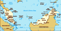
Pulau Labuan
I left Brunei on
the 25th of February by ferry (see my
last blog). Which was just the latest leg of my multi-year around the world trip (click
here for the link to previous blogs).
The ferry took me to the offshore island of
Pulau Labuan, which is a tax free haven and financial centre off the coast of Sabah. I spent the night on the island before continuing to the capital of Sabah,
Kota Kinabalu. K.K. as it is popularly known is set between tropical hills and the South China Sea. It is the state capital but didn't become the capital until after the Second World War when Sabah became a British Crown Colony for a short period before Independence and joining the Malaysian federation.
In fact Sabah was run by a private company, the
British North Borneo Chartered Company between 1882 and 1942. In 1942 Sabah was occupied by the Japanese. It only became a British Crown Colony because the company couldn't afford the cost of re-construction after the 2nd World War.
All bookings for climbing Mount Kinabalu are done through Sutera Sanctuary Lodges. I discovered I would have to wait several days until I could climb the mountain because all
the accommodation in the mountain huts was booked out in advance.
So, I thought it would be an idea to take the only train line to the town of
Tenom. Except I found that the
North Borneo Railway was closed down for maintenance. The views from the train are supposed to be spectacular but it looks as if it will be closed for most of 2007.
Instead I went to Tenom on the bus.
Tenon and Sabah Agricultural Park
Tenom is a small town in the interior of Sabah. It is in the centre of the area where the Murut hill tribes live. Many Murut warriors were killed in the giant uprising against the British colonists in the Rundun District in 1915. Even today many Murut 'warriors' still take their blowpipes and hunting dogs out to the jungle to catch supper.
Whilst in Tenom I visited
Taman Pertanian Sabah (Sabah Agricultural Park). The Park has an amazing collection of native and introduced plants, landscape gardens and educational activities. There are also extensive jungle trekking trails in the area.
From Tenom I returned to KK via Kenningau.
The diving crew, Pulau Sipadan
I'm the one wearing a T-shirt. The others were all tall tanned Scandinavians. Kinabalu Park
I finally made my way to the
Kinabalu Park on the 3rd of March. It was only a 2 hour bus ride to the Park. I spent the first day walking trails within the park below the mountain.
The next day on the 4th of March I began my 2 day trek up the mountain.
I stated early, meeting my guide Abdul at 7.30am at the Park Headquarters. I had the foresight to hire a walking stick. It is compulsory to hire a guide. The climb of Mount Kinabalu is for most people a 2 day trek with a stop at km6 along the trail. Although some people have been known to run up the mountain and back in 3 hours! The trail was steep and it soon became hot in the sun. So, I took it very slowly taking 6 hours to get to Labuan Pata (km6), which is the rest stop for the night. I was staying in a hut 100m downhill from the restaurant at Labuan Rata. My hut was called Waras Hut. It was a hut made of corrugated iron with no heating. I was in a 4
bed dormitory. (It was the only place available). When the sun went down it got very cold.
Are we there yet?
My accommodation, Waras Hut was the first building that people arrived at when they got to the rest stop at Labuan Rata. In the evening the couple I was sharing with and myself watched late comers as they arrived just before sunset. It was better than any 'reality' TV. Everyone that passed us asked how far it was to the Labuan Rata check in. We assured them it wasn't far. The fact that some people were still arriving just before sunset means that they must have taken at least 7 hours to climb the mountain. No one is allowed to leave the starting gate of the trail after 11am in the morning. The entertainment was topped off by one of the most spectacular sunsets I have ever seen.
Conquering Low's Peak
My cellphone alarm woke me at 1.50am. I got dressed and staggered up the hill to the restaurant for an early 2am breakfast. At 2.30am I set off for the top of the mountain with my guide Abdul. It
was not that dark because there was a full moon. My guide wasn't carrying a torch although I was wearing a head torch. I could see a surprising amount even without the torch because the full moon lit up the mountain side. It was a difficult climb - the first part was uneven huge granite rocks. I was dressed for the cold. After about half a km we came to the most dangerous part of the climb. From this point on there is a rope to the summit. When the rope starts there is a large notice warning of danger and insisting that people use the rope. Abdul told me that I had to use the rope for the next 250m. I didn't really need encouragement. The ground obviously fell away very precipitously. I was glad that I couldn't see too far down the side of the mountain as we were obviously hanging off the side of it. After 250m hauling myself along the rope the climb became easier. From this point onwards I was walking on a solid granite floor that was inclined steeply upwards. I didn't rush it.
Finally we got to a hill at the
end of the trail that appeared to be made up of large granite rocks. We had made it to Low's Peaks. I scrambled up the granite rocks and found that I was one of the first to make it to the peak at 5.45am. I was one of the first to the peak because I was one of the first to start the climb in the morning. The couple I shared a room with didn't start their climb till half an hour after me.
The view from Low's Peak at sunrise was sublime, with Borneo set out beneath us.
I climbed down from the very peak to a point just below in order to allow other people to have their photos taken on the top. I stayed just beneath the summit until 6.30am.
Limping down Mount Kinabalu
The climb back down to the rest camp at Labuan Rata wasn't too difficult. Although this time I could see have far the drop was when I was hanging onto the rope. I tried not to look down too often. I arrived back at the base camp at 8.15am. As I walked into the restaurant I noticed one
Sunset at Waras Hut, Km 6 on the trail up Mount Kinabalu
Waras Hut was my accommodation for the night on the trail up Mount Kinabalu, before attempting the summit. I reached Low's Peak at 5.45am the next morning. woman being carried into the restaurant with a man on each side supporting her. I rested at the camp till 9am, when I continued the walk down.
Whilst I was in the rest camp I managed to twist my ankle, which caused me a lot a trouble on my way down. The trail in the area just below the camp is full of very uneven granite rocks. My right ankle was weakened. In the first couple of 2km climb down from Labuan Rata I kept falling over as I re-twisted my ankle.
I had already fallen over 3 times. The path I was on was very narrow - on this stretch there was no passing room. So, I felt under pressure by people behind me to speed up. I started walking faster and fell again - this time forwards (on the other occasions I had fallen backwards onto by bottom). I fell forwards down the mountain. Fortunately Adbul my guide caught me.
We sat down. Someone offered cream to soothe the pain. Someone else produced an elasticated bandage from their bag. So, Abdul and the passing stranger bandaged up my ankle. This happened just before KM4 on
the climb. I still had another 4km to walk down the mountain.
I took the rest of the mountain very slowly, but didn't fall again or re-twist my ankle. I made it down the mountain from the rest camp at Labuan Rata in 5 and a half hours. Every step down that mountain was a struggle.
Rest
I hadn't booked anything in the park for the day that I walked down the mountain. I could hardly walk. The easiest option was to get the shuttle bus back to KK, which is what I did. Once in KK I booked into a 4 star hotel to treat myself to some luxury. The
Jesselton Hotel was opened when Sabah was still a British colony. It retains a certain colonial charm. It even has doormen dressed in colonial style safari suits and hats. I only stayed in the Jesselton one night but I stayed in KK for 3 nights. It took that long to recover. My ankle recovered quickly but I swear every muscle in my legs and knees was complaining for days! So, during that time I did very little, walking was painful!
Sandakan and Sepiloc
Orang-Utang Sanctuary
After my rest in KK I took the bus to
Sandakan, which is the second largest town in Sabah. It used to be the capital of North Borneo when the colony was run by a private company. But after World War 2 the capital was moved to Kota Kinabalu (then known as Jesselton). Sandakan and KK were destroyed in the war. It took me all afternoon to reach Sandakan from KK, so I didn't visit Sepiloc till the following day. Downtown Sandakan is very grim - run down, dirty concrete blocks. There is a large building site on the waterfront where they are obviously building a new waterfront for the town. A few of the buildings are already open, like the new market, but most of the waterfront is a building site. Behind the building site are the very dirty, run down concrete blocks that don't look as if they have been maintained since they were built.
The
Sepiloc Rehabilitation Centre is 15km outside of Sandakan. I visited it on the 9th (see the photos on this blog).
Semporna and Pulau Sipadan
There is one direct bus from Sandakan to
Semporna. I couldn't
be bothered to catch it as it leaves very early. Instead I caught a minibus to Lahad Data which meant a 1 hour wait for the vehicle to fill. When it finally got to Lahad Data, I couldn't be bothered catching another minibus that day. Although someone tried to recruit me into their minibus I could see that they had no passengers. So, instead I decided to stay in Lahad Data for the night before carrying on to Semporna the next morning.
Semporna is a gateway for tourists, before proceeding offshore, to some of the country's finest diving sites including the world knowned Sipadan and Mabul Island.
Pulau Sipadan is probably the best diving site in the world. I though don't have any underwater housing for my camera. So if you want to see some photos I would recommend that you click
here for Ali's blog on this site.
I saw turtles, (small) sharks, hundreds of colourful fish I can't name and found myself swimming amongst huge parrot fish.
After Semporna and Sipadan I visited the border town of
Tawau before leaving Sabah.
Advertisement
Tot: 0.159s; Tpl: 0.016s; cc: 14; qc: 24; dbt: 0.0681s; 1; m:domysql w:travelblog (10.17.0.13); sld: 1;
; mem: 1.2mb