Advertisement
Published: September 11th 2012
Sorry for the frequency of the Travel Blogs but I am in Cape Town with great internet service!!!!
Zanzibar and Driving to the Ruaha River & Iringa 10 – 11 August:
After getting up at 5.15am, having breakfast in our room, we were picked up at 6.00am as we had to catch the 8.00am ferry back to Dar es Salaam. We had to go out through immigration on the Island but there was no need to show our visa when we got onto the mainland.
The ferry was very fast and the waves were BIG! 5 of our group were sea sick during the trip. I was sitting in the outside section looking backward and I was doing my blog on the computer. When the computer (which was on my lap) nearly went sailing off with one of the big waves, I decided to put it away!!!.
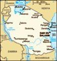
We arrived at Dar es Salaam at 10.00am and Raymond our bus/truck driver was waiting for us. We went into the city (another gridlock!) and stocked up on water and he stocked up on food.
We use
a toilet when we stop but like many toilets overseas, they are the squat type and disgusting. We are starting to ‘enjoy’ bush toilet stops more!!! It was pretty funny one stop when I looked around and there was 8 women’s heads peeking above the bushes as they squatted.
On the way to the Tan Swizz Hotel where we were staying the next night, we stopped off at a roadside restaurant for a traditional Tanzanian lunch – spicy rice, multi flavoured lentils, beef, chicken and fish dishes which had the local spices added, corn mash (looks like potato) and cooked green bananas. The last time I had green bananas was on the Kokoda Track.
50 Kms before arriving, we drove through the Mikumi National Park. As it was a main highway we could not stop for photos of the animals. We say giraffe, Impala, buffalo, elephants and an endangered, very large bird from South Africa.
We arrived at our stop at about 5.00pm, set up tents and had the most magnificent hot shower. Fantastic! There was a great bar, about 5 individual shelters with lounge chairs and table in each. They
also had reasonably new brick accommodation. In addition, there were geese, guinea fowl, a dog with 6 pups, chooks and 4 noisy roosters – and yes they woke us the next morning.
There are only 4 of us from the original group so it is great to get to know the new people who joined us in Zanzibar. We built a bomb fire and roasted marshmallows after dinner. Dinner was chicken, pasta and spicy vegies and salad.
As our group was down to 16 people, Tom and I used 2 mattresses each – much better. There were a couple of showers of rain overnight but dry by the morning.
Saturday 11 August – travelling towards Iringa:
We packed up camp and got away by 7.30am. After leaving, we started to climb a Ulugulu Mountain Range, following one of the Ruaha River tributaries. The valleys were very steep. Before we reached that area, we travelled through farmland.
The Great Ruaha River is a river in south-central Tanzania that flows through the Usangu wetlands and the Ruaha National Park east into the Rufjii River. The population of the basin is mainly sustained by irrigation and water-related livelihoods
such as fishing and livestock keeping.
Great Ruaha is about 475 km long, its tributary basin has a catchment area of 68,000 km² and the mean annual discharge is 140 m³/s. The Great Ruaha River supplies 22 per cent of the total flow of the Rufiji catchment system. Thirty-eight species of fish have been identified in the Great Ruaha River. It also has the greatest population of crocodiles in East Africa.
The river's headwaters are in the Kipengere Range. From there the Great Ruaha River descends to the Usangu plains, an important region for irrigated agriculture and livestock in Tanzania. The river eventually reaches the Mtera Dam and then flows south to the Kidatu Dam. These two generate about 50 per cent of the Tanzania's electricity. The river continues southwards and flows across the Selous Game Reserve before reaching the Rufiji River.
We then travelled through an area that was full of Baobab Trees, through the Baobab Valley. There were 100s of them – without leaves.
We were heading towards Iringa where we were staying the night. On the way we stopped off at Iringa’s Neema Craft Centre which is an award winning centre. Iringa is
famous for its woven baskets, made from local reeds. The baskets are used across Tanzania and also exported internationally. They are also known for its paper that is made out of elephant’s dung!! The workshop at the Craft Centre employs deaf people who produce the elephant dung paper products (cards, albums, etc), beaded bits and bobs (bracelets, earrings, flip flops) including stuff from their beads they make from recycling glass bottles, cushions, vitenge patchwork blankets, lamps and lamp shades, and more recently have employed disabled folks who are weaving rugs, hammocks, and various other interesting textiles. Their most recent projects are micro solar panels for lighting, radios and charging phones, very useful if you are camping, and a physiotherapy unit for disabled children. You can help the physiotherapy unit by having a fantastic hour long massage for 25,000/= from their bubbly physio Beatrice and you can lie there and relax in your pampering knowing the money you are paying is going to allow more disabled children to get treated for free! Unfortunately we didn’t have time to stay.
Haruna, a hilarious character, was happy to give a guided tour around the Centre. They have a café selling proper coffee
and homemade cakes, ice cream and sorbets if that tickles your fancy; Also they are the centre for a great project to bring safe drinking water to rural villages using the sun, (SODIS.ch) so drop off any empty 1 1/2 litres drinking water bottles you may have and they can make use of them.
Iringa is a city in Tanzania with a population of 1
20,000. The name is derived from the Hehe word
lilinga, meaning fort.
Iringa is the administrative capital of Iringa Region. It has many established industries, including manufacturing and food processing. Most of its electricity comes from the nearby Mtera Dam. Iringa is a minor transport hub, with regular bus service and trucking to Dar es Salaam.
Iringa was built during the 1890s by the German Army as a defensive base to be used against the Hehe uprising led by Chief Mkwawa. The fortress and headquarters of Chief Mkwawa was situated in the nearby village of Kalenga. The town stretches along a hilltop overlooking the Ruaha River to the south, and spreads along ridges and valleys to the north. The altitude of the town's environs is more than 1550 meters above sea level. The
months of June, July, and August can see low temperatures near freezing. The Tanzam Highway passes through the valley below the town; the highway distance from Iringa's limits to Dar es Salaam is 502 kilometers, via Morogoro.
The other things to see at Iringa are: Gangilonga Rock (talking stone). This large rock gave a great views over Iringa. To get to it you have to walk out past Lulu's/bakery/Ruaha Club way through the well-off suburb where all the rich NGO and government workers houses are. The rock itself is covered in graffiti from Local youth.
Isimila Stone Age Site. About 15 kilometers from town towards Mafingai. This is one of the most interesting stone age sites in East Africa contains archaeological artefacts, particularly stone tools, from human habitation about 70,000 years ago.
AIDS Pandemic - Iringa region has the highest infection rates in the country. The Amani Orphanage in Mbigili (around 15 km from Iringa) is run by a German-Tanzanian NGO has many children who have lost their parents from AIDS.
We arrived at Iringa at 3.30pm. We were staying in the Kisolanza Farm Campsite which was on a farm. It was one of the most
established campsite we had stayed at – bar x 2 (one with hay bales all around the wall), restaurants, individual accommodation, beautiful warm showers and the cleanest ‘long-drop’ toilets I have ever seen (including no odours!).
Several of us went for a walk around the property for 1 ½ hours which was excellent. We came across some cattle, a lake with windmill. They grow tobacco and organic vegetables.
That night we had a traditional Tanzanian meal using the produce grown on the property. Tom was selected the ‘statesman’ for the evening so he had to choose 4 wives after they dressed him up in traditional clothing. Fortunately he chose me as his number 1 bride, along with Japanese, Swizz and English girls in our group. We were all dressed up in the traditional outfits. We were taken from the bar to the restaurant, following a local who was beating a drum. We then went to the other ‘bale bar’, again following the drummer, to have hot chocolate and chocolate brownies. We all stayed in our role as Tom’s 4 wives, until then.
We were in bed by 9.30pm for an early start to drive to Malawi.
Advertisement
Tot: 0.084s; Tpl: 0.013s; cc: 18; qc: 30; dbt: 0.0417s; 1; m:domysql w:travelblog (10.17.0.13); sld: 1;
; mem: 1.2mb

")
")


")
")
")
")
")
")
")
")
")
")
")
")
")