Advertisement
Published: August 22nd 2010
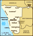
The World Cup officially ended July 11th, however the last match in Cape Town was on July 6th, which was also the last day I had volunteer duties. I hadn’t booked my return flight back to the US until August 3rd, giving me a few weeks to travel around southern Africa. I expected to hear about interesting places to go while I was based in Cape Town. Ironically, the most intriguing destinations to me were outside of South Africa. Namibia, a mere 6 hours away from Cape Town, was the closest option. On the other hand, Mozambique, on the far opposite side of South Africa, is known for its majestic, isolated beaches. I decided to aim big. Why not take a mega-road trip through Namibia, to the other intriguing destination of Botswana, quickly passing through Victoria Falls, over to Mozambique and finally ending in Johannesburg to catch my departing flight on the 3rd? Why not, indeed! Well, that’s actually a ridiculous amount of driving. After no responses to my couchsurfing post and friend-of-friend contacts looking for travel companions, it was clearly time to refine and redefine my route.
South Africa has a website, much like Craigslist, called Gumtree. Deadline growing
near, and not an interested soul in (virtual) sight, I perused Gumstree’s classified section and found a post entitled, “fancy namibia?” That post was from Jan, a blond-haired, dread-locked German traveler most recently working at a winery in Tasmania. The day after I had made arrangements to meet with Jan to discuss possible travel plans, Eric, an American from Seattle who recently closed up shop to explore working opportunities abroad, responded to my couchsurfing post. The three of us met on a Friday, and outlined our travel plans to commence that Monday. Later that night, I excitedly exchanged google map links with Eric delineating different possible routes and projections on how many days it would take to complete them. We’d be dropping Jan off in Windhoek, the capital of Namibia, to catch a flight. Eric and I would make the drive back to Cape Town in our rental car, hopefully passing through Botswana beforehand. I fell asleep that night content with the two-week itinerary we had devised. I woke up horrified.
Fourteen days in a car?!! I get antsy after sitting in a car for more than 2 hours. What was I thinking? And we were supposed to be
 Campsite, Night 1
Outside Ai-Ais Hot Springscamping along the way. I’m a city girl. No one ever taught me how to camp! Balance a checkbook, sure. Set up a tent? Ah… not so much. Oy vey.
We had planned to meet again the following day but sickness on Jan’s part and inclement weather kept Eric and I in our respective homes. In the meantime, both of the guys were recruiting other travelers to join our expedition. Come Sunday, the day before we were planning on leaving, a young American couple joined us over breakfast as we ironed out our travel plans. Duties allocated, the new pair went off to buy miscellaneous camping gear. There were some glitches in renting a vehicle. We were hoping to secure a camper van - Eric and I had both submitted online reservation requests with the same company, only to find out that the entire fleet was in Johannesburg and the company had no intention of moving any of the vans to Cape Town. A second glitch, the couple sent out an email at 3am backing out. They were too broke, plans had transpired too quickly and they just didn’t know us that well, “ya know?” Monday morning, tents and
Fish River Canyon
The second largest canyon in the world. sleeping bags gathered, Eric found an affordable Toyota Corolla to rent. Off he and I went to pick it up, all the meanwhile dealing with glitch #3. Eric was having stomach problems! It was the day after the World Cup finals. The entire country had a hang over (international volunteers included). But he had something worse requiring proximity to a toilet. Now with a rental car and Jan on board, we drop off Eric to rest for a bit. Jan was biting at the bit to get out of town. I, too, had had more than my fill of Cape Town. Low and behold, a couple hours later, Eric phoned. He was feeling better and was ready to hit the road. Game on!
The first day we drove mostly in the dark, making for the Namibian border. We arrived almost precisely at midnight. It was the most… well, perhaps the dumpiest border crossing I’d experienced. I loved it! The “important phone numbers” list was hand written in sharpie on faded and torn paper. Piles of boxes with papers spilling out were stacked haphazardly along the back of one wall. Duct tape, which once had covered the air ducts in
what I assume was an attempt to control the air conditioning, hung loosely from above like fly paper. Ah, Africa! After about 15 minutes of informalities both leaving South Africa and entering Namibia, we were on our way. Our goal, which we accomplished, was to camp outside of Ai-Ais Hot Springs, not far from the world’s second largest canyon called Fish River. Our second day on the road then, entailed a quick trip to the hot springs (a bust due to it entirely being part of a resort) and a hike around the top of Fish River. Unlike the Grand Canyon, there weren’t trails you could take into the canyon for a few hours, much to my dismay. There is only one trail that leads to a 3 - 5 day hike. We did, however, speak to some other people who were traveling on their own around Namibia and based on their advise, took a route I had voted for, but was previously ruled out due to being too far out of the way. We ended up spending the night at the port town of Luderitz.
There wasn’t much doing in Luderitz, although our campsite sat on a lovely
bay. This site would present the first of nightly sunsets that never failed to take the breath away. Jan was enamored because the town looked identical to a German town. Our dread-locked friend even requested we go by a couple of churches so he could take pictures of the architecture. On the way to and fro Luderitz is a ghost town called Kolmannskuppe. It used to be a diamond-mining town. With time, and innovation, the diamond mining industry moved to other areas, and Kolmannskuppe, settled on top of dry, loosely packed dunes, was left to be buried in the sand. Literally, I saw employees shoveling sand out of abandoned houses (what a job!). I loved this ghost town. Being someone who always wants to trespass behind the “Do Not Enter” signs, the “Entering of Buildings At Own Risk. Some of the Buildings Could Be Unsafe” sign read like an invitation to go to town. This was my kind of playground!
After a couple of fun-filled hours there, we hit the road again making our way to the famous sand dunes of Sossusvlei. Again, we camped on the side of the road, waiting until the next day to enter the
Entering of Buildings...
...is at own risk! Sign me up! Sesriem campsite. After three days of heavy driving, it was time to luxuriate in the nothingness next to the red dunes. It did feel luxurious even though there really wasn’t much there to see or do. But it was spectacular! One of the key attractions is getting to the gates to this national park right when it opens so you can drive in and watch the sun rise over the dunes. Impatiently, we waited for the gates to open the next morning, only to discover there was a one-hour time change when we drove straight north and entered Namibia. Instead of getting up at 5am, we had risen at 4! Regardless, I think the boys quite enjoyed the dunes. I was cold. It was early. No coffee had passed my lips. And frankly, the sand dunes I sand-boarded in southern Peru were way cooler. I guess what I’m saying is that I wasn’t that impressed. However, after the sunrise, we walked on to Death Vlei and the red of the sand was beautiful to take in, especially contrasted against the white of the Death Vlei dried lakebed.
Another mission accomplished, we booked out of Sesriem and hit the road.
Around dusk, we arrived in the second largest city in Namibia, Walvis Bay. After 5 days of driving amongst dusty nothingness, eating canned tuna, canned vegetables and cous-cous, entering the market in Walvis Bay was like a Eureka moment. Holy options! After a quick shopping effort, we continued on about an hour north to the town of Swakopmund. Another eye opener - it was a resort town! Didn’t feel like the Namibia we had been in at all. But really, really nice! Jan was especially happy because in both places, he had found some of his favorite German-style sausages for cheaper than at home. Pleased as a pig in a trash bin!
By this point, we were way ahead of schedule. Originally, we thought making it to Etosha National Park, known as one of the best wild game reserves on the continent, was nearly impossible given our time line. But after some scheming, and convincing Jan to blow off some babe he was supposed to meet two days later in Windhoek, a new plan was hatched. We would spend the next two days moving at a leisurely pace to visit the famous White Lady cave painting located inside the
Here comes the sun
Sunrise at the sand dunes Brandberg Mountain; then move on to Twyfelfontein, a UNESCO World Heritage Site containing one of the largest concentrations of rock carvings in the world. At the end of the second night, we’d camp right outside Etosha National Park, ensuring we’d be at the gate right at opening time.
And this is what we did. Brandberg Mountain was stunning. The White Lady cave painting was an interesting visit but it was the magnificent pomegranate-red sun setting behind this tallest summit in the country that will remain a highlight of my trip. The rock carvings of Twyfelfontein were also cool to see. But what really made the trip special was the rust-colored rocky landscape. And the sunsets. There was one evening, where we were driving through a tiny town, which was nothing more than a handful of houses, kids were running around everywhere and playing as dark cloaked the day, and the sunset backdrop… man, I fell in love again with Mother Earth then and there.
Etosha National Park was pretty much the end of our trip. We spent an incredible day driving to different watering holes where we saw lions lazing about, giraffes, zebras, elephants, ostriches, rhinos, wildebeests, warthogs,
Sunrise at the dunes
The light of the rising sun made the dunes a special shade of red. orynx, kudu and springbok. It was my first time in a game reserve of this size (about 9,000 sq miles), seeing so many wild (and big!) animals up close and personal. I was as giddy as a schoolgirl. As the sun set and the park closed to all those not camping inside, we took the east gate exit and hightailed it south to Windhoek.
If I've failed to mention all the headaches, arguments and road bumps along the way, it's because there weren't any. It was amazing that I could hit the road with 2 complete strangers and have less personality clashes (and any other kinds that exist) than when traveling with friends. Honestly, every day seemed to work out magically. No bickering, no heated political debates and pretty much everyone got to see and do what they wanted. As if everything weren't all serendipitous already, that last night in Windhoek, we couldn't find the place we wanted to stay (no map!). I swear to you, the only time we saw a police man in the entire country was when we had stopped at a gas station to ask for directions. The officer was not only there to help
guide our way, he drove (we followed) to our destination. He was our angel of Namibia!
The next day, Jan had a flight to catch. And I had made arrangements to bring another young lady traveling alone through Africa back to Cape Town with us. We ended up driving 14 hours that last day. Windhoek to Cape Town. I wasn’t sure we would do it all in one shot. In fact, I never got to mail my postcards, already with Nambian stamps, from inside the country. No matter, it worked out in the end. In total, our car calculated that over 10 days, we had driven 5,378.7 kilometers (3,342.2 miles) and spent 64 1/2 hours in the car. This trip to Namibia ended over a month ago now (yes, yes, I’ve been slacking). Yet so many of the memories are still fresh in my mind. With my World Cup volunteer experience over and me back in the U.S., its natural for people to ask me what the highlight of my trip to South Africa was. My answer: Namibia!
Flickr Photo sets can be reviewed
here .
Highlights:
Etosha National Park Sand Dunes near Sesriem Kolmannskuppe Ghosttown
Advertisement
Tot: 0.278s; Tpl: 0.032s; cc: 8; qc: 54; dbt: 0.1095s; 1; m:domysql w:travelblog (10.17.0.13); sld: 1;
; mem: 1.2mb


Ashley
non-member comment
Who knew??
Love the trip notes and aWesome photos! Also - who knew about fish canyon. Wow!