Chadian Geography, Chad Geography
Advertisement
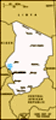
Location: Central Africa, south of Libya
Geographic coordinates: 15 00 N, 19 00 E
Map references: Africa
Area: Total: 1.284 million sq km land: 1,259,200 sq km water: 24,800 sq km
Area - comparative: Slightly more than three times the size of California
Land boundaries: Total: 5,968 km border countries: Cameroon 1,094 km, Central African Republic 1,197 km, Libya 1,055 km, Niger 1,175 km, Nigeria 87 km, Sudan 1,360 km
Coastline: 0 km (landlocked)
Maritime claims: None (landlocked)
Climate: Tropical in south, desert in north
Terrain: Broad, arid plains in center, desert in north, mountains in northwest, lowlands in south
Elevation extremes: Lowest point: Djourab Depression 160 m highest point: Emi Koussi 3,415 m
Natural resources: Petroleum, uranium, natron, kaolin, fish (Lake Chad), gold, limestone, sand and gravel, salt
Land use: Arable land: 2.86% permanent crops: 0.02% other: 97.12% (2001)
Irrigated land: 200 sq km (1998 est.)
Natural hazards: Hot, dry, dusty harmattan winds occur in north; periodic droughts; locust plagues
Environment - current issues: Inadequate supplies of potable water; improper waste disposal in rural areas contributes to soil and water pollution; desertification
Environment - international agreements: Party to: Biodiversity, Climate Change, Desertification, Endangered Species, Ozone Layer Protection, Wetlands signed, but not ratified: Law of the Sea, Marine Dumping
Geography - note: Landlocked; Lake Chad is the most significant water body in the Sahel
Advertisement
The information here has been derived from Public Domain Sources such as the CIA World Factbook. No liability can be taken for any inaccuracies.
Tot: 0.066s; Tpl: 0.007s; cc: 6; qc: 6; dbt: 0.0107s; 1; m:domysql w:travelblog (10.17.0.13); sld: 1;
; mem: 1.1mb
 Chad, part of France's African holdings until 1960, endured three decades of civil warfare as well as invasions by Libya before a semblance of peace was finally restored in 1990. The government eventually suppressed or came to terms with most politic...